day 1 pokhara tour: lumbini - tAnsen

tour homepage next day

september 14, 2011:

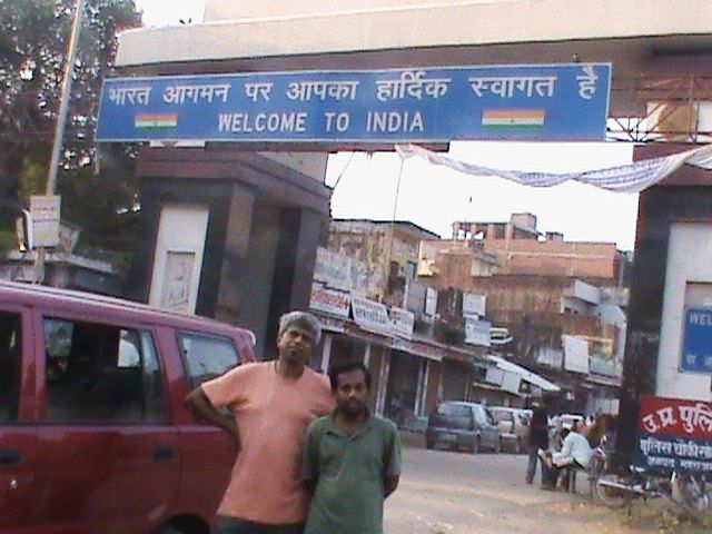
yours intrepidly - from the nepal side of the border

at the border at dawn: start from kanpur on tue 13 sep at 20:40, our bicycles at the back of a tavera. faizabad by 1AM, gorakhpur 4AM, Sunauli (border) by 6AM

paperwork for car - bhansAr - charges are NR 400 per day plus 13% tax - documents get done smoothly, no golmAl, all payments as per receipt... in fact it is the indian police who ask for rs 200 "fee", but our driver Anand says we can pay it only against receipt. it is then waived...

formalities over by 7:30. we then find a hotel to freshen up in - hotel sangam near the turn to lumbini.


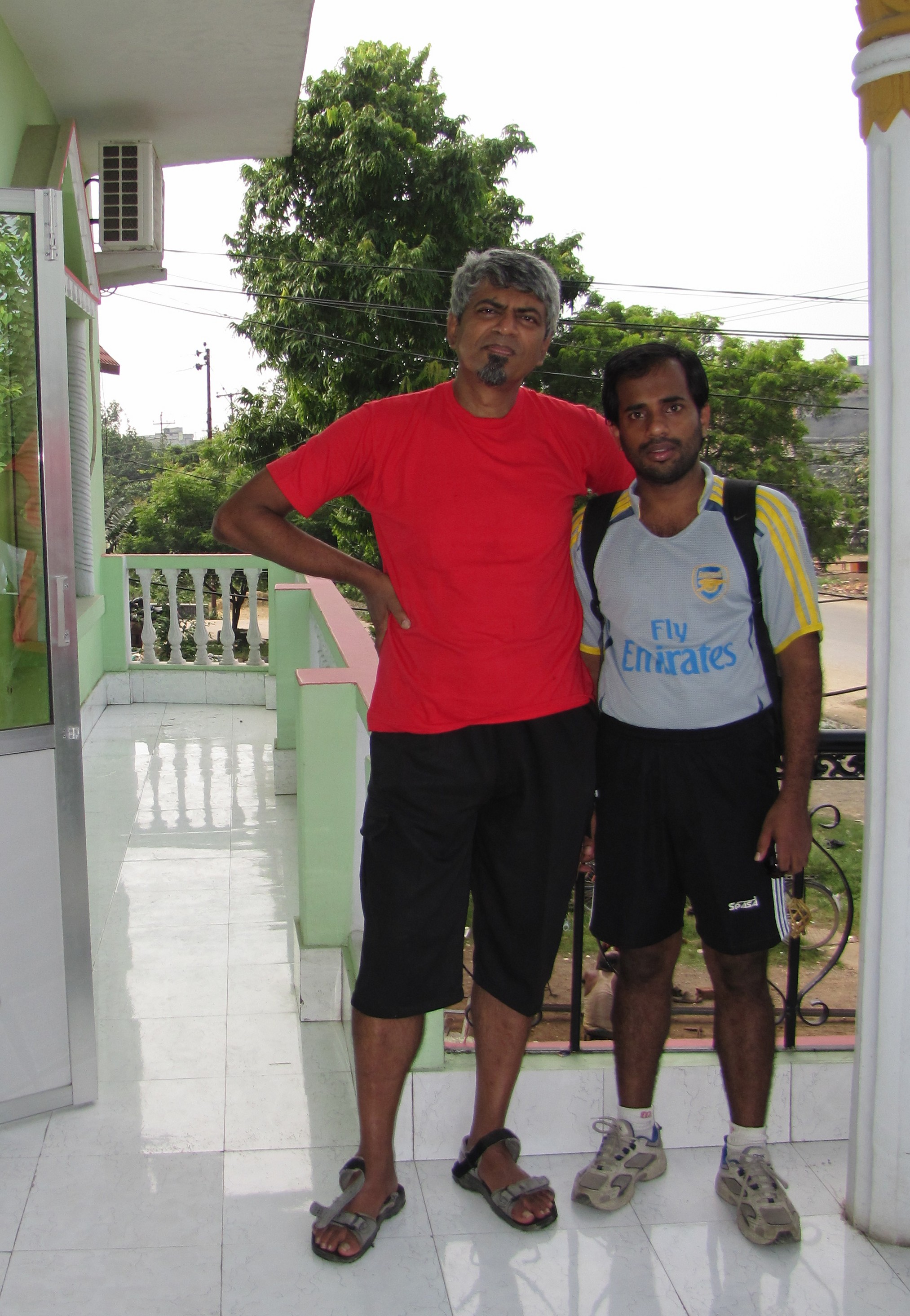
amit and binoy: in bhairahawa hotel; starting off for lumbini.

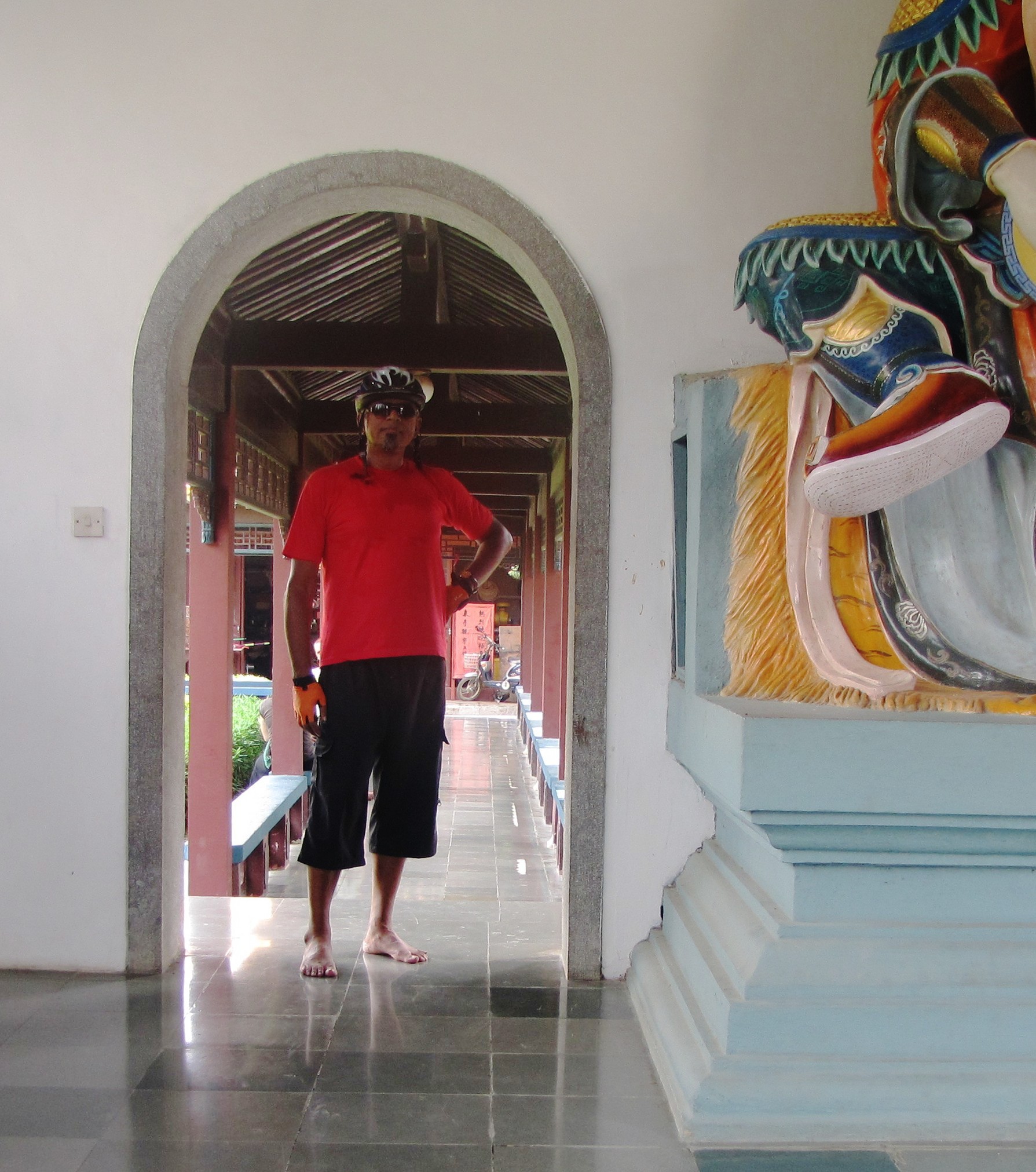
exploring lumbini gardens

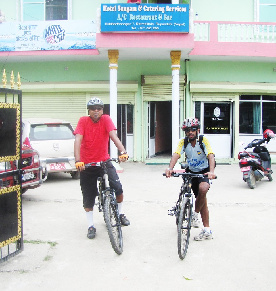
aluparatha breakfst and set off for lumbini around 10. it is 21km, but we get lost and overshoot (i am looking for a canal shown in the map). eventually, we find our way and spend some time at the chinese temple with the fat smiling buddha and the guards and the joss sticks...


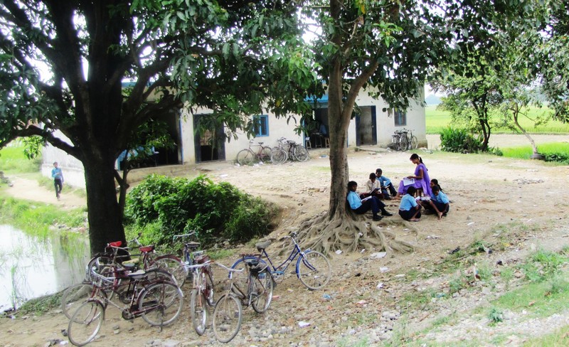
open air school en route to lumbini. binoy at a stream approaching lumbini gardens.


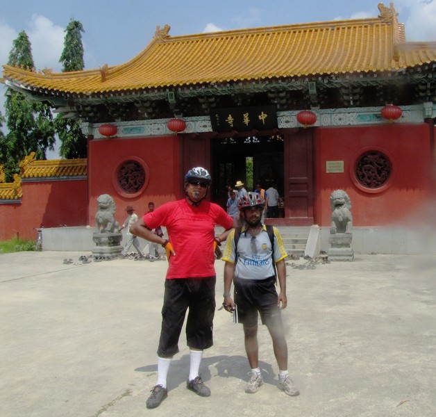
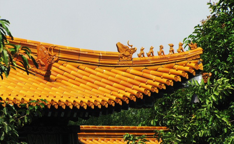
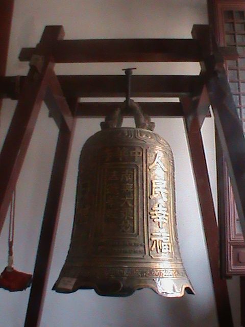
at the chinese temple. decorated roof ornaments. ornately cast bell.

then we go down to the mayadevi temple which is the main site where buddha is supposed to have been born in the sAl vihAra, woods of pine. at the heart of this temple is the ashok pillar - but it's a short squat smooth cement-like pillar - not at all like a 3d c. BCE stambha.

the main building covers the archaeological finds of the area - this includes a marker set up by ashoka during his visit, at the likely spot in the lumbini garden where queen mayadevi drank the water of a pond and then held the branch of a tree and gave birth to siddhartha. the site includes a marker stone presumably from the period of ashoka's visit. we observe it through a lattice of iron rods where a proposed floor and glass enclosure may be coming up. the marker is below ground level - it has presumably been excavated.

by the time of ashoka (about four centuries after buddha) the site had already been overgrown by jungle, but ashoka established a temple complex which was a thriving buddhist monastery for many centuries but fell into disuse after the large-scale disappearance of buddhism from the region around the turn of the millenium.

so the site was again overgrown with jungle by the 16th c.; rediscovered in 1896 by british-nepali group; UN interest since U Thant visit (1967) - since then almost all Secretary-Generals seem to have visited (see page on UN and Lumbini); Kenzo Tange master plan in 1970 (map below), still being implemented.


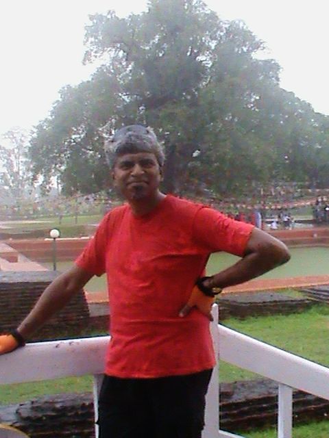
it starts to rain at the mayadevi temple.


a big group of women, who had come to pray for rains, start to dance in the nearby grove.

it starts to rain as we are in the mayadevi complex and we get drenched. apparently it has been a drought-like situation - this is the first time it's rained in a month and the harvest was in serious jeopardy. as we are there a group of village women from the neighbouring ardauli village have gathered under a huge banian and they start to dance and sing - we walk over amid the pouring rain and binoy stands under someone's umbrella and makes a video of their dance.

we walk back to our bicycles in the rain but it eases even as we start cycling. on the way back, we make it from the turn to the lumbini complex back to the hotel in very good speed - 18km in 38 minutes (avg ~30kph).


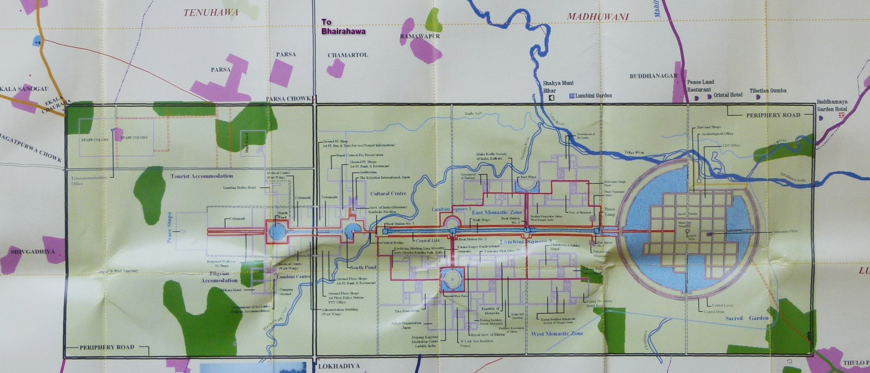
map of lumbini area (click to enlarge). the map reflects the UN sponsored Kenzo Tange plan, many parts of which are incomplete. so the canal crossing the road coming from bhairahawa, has not been built yet and i overshot the turn while looking for it. (source: nepal tourism foldout on lumbini)

onwards to tansen

now it's raining again and anyhow the stretch to butwal is boring, so we load the bicycles into the car and head down the highway to butwal. here we need to visit the RTO to get road permits made. by now it's nearly 4pm and the sky looks darker than it should because of the rainclouds. we have a late lunch of momos. mutton and beer, and we start for tansen.

the hills start immediately and 3-4 km on, we get off the bikes and start riding through the light drizzle.


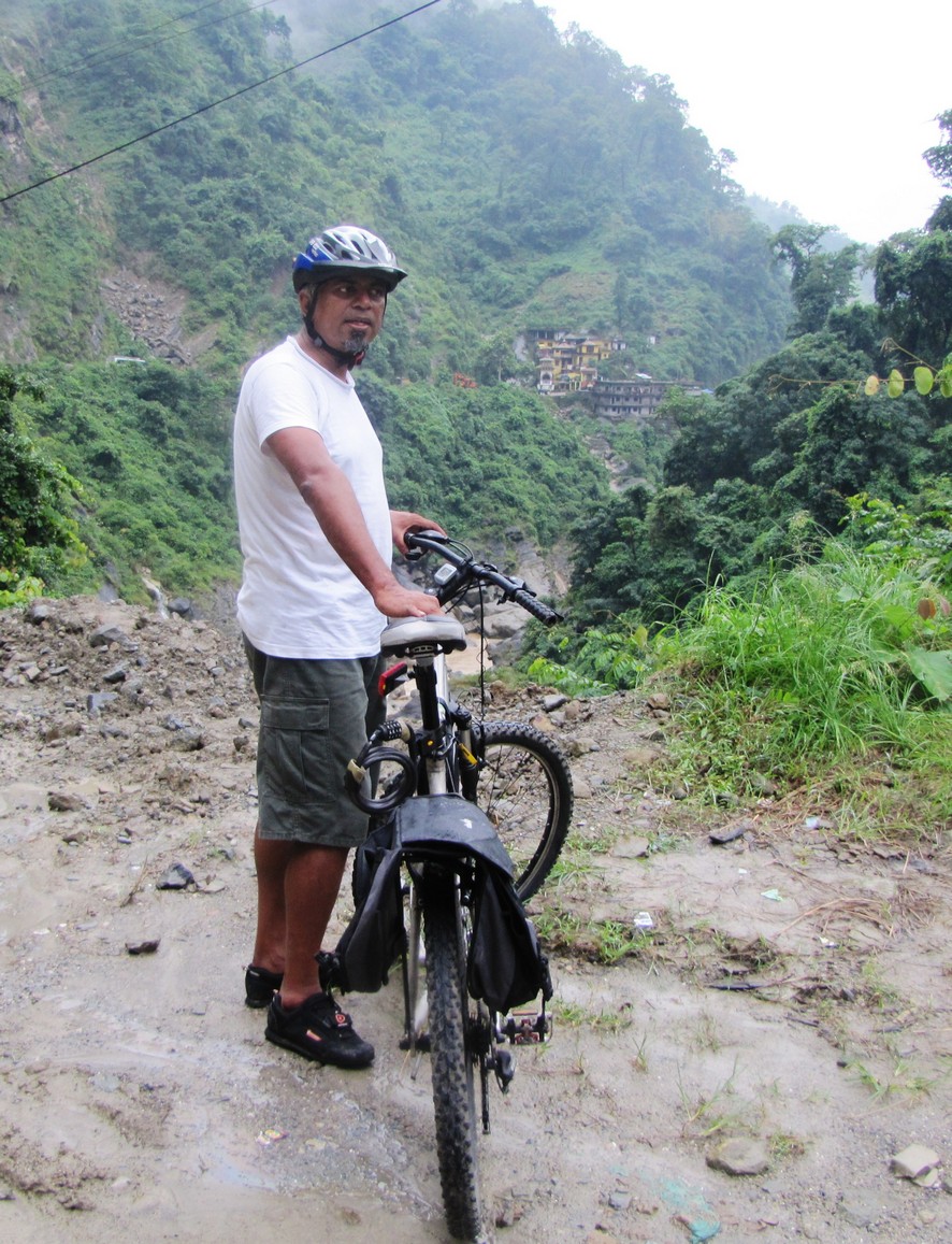
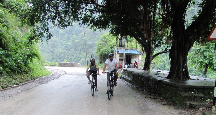
riding on the hills in the jhumsa valley above butwal.


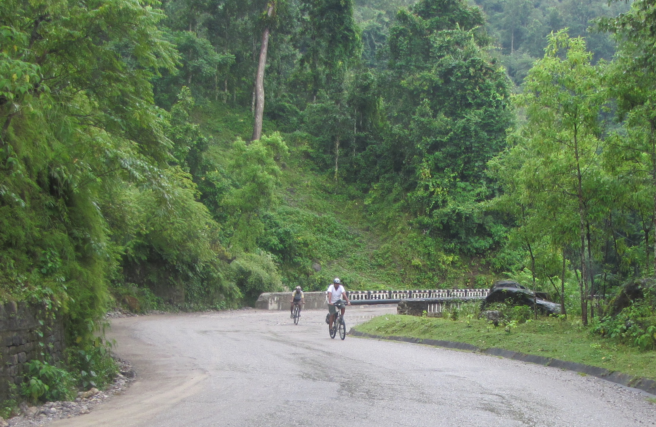
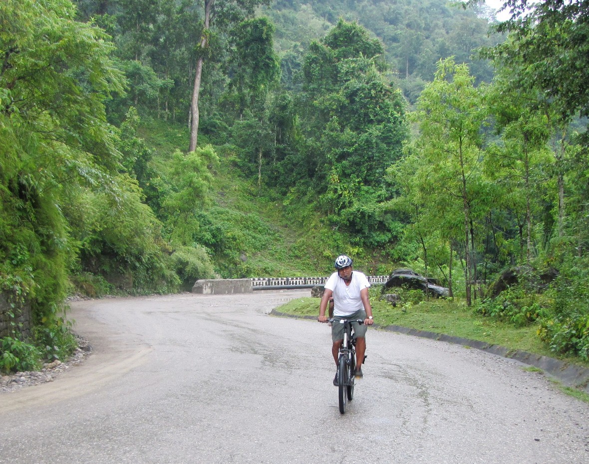
the lush green valleys along the jhumsa khola. the sky and the hills were grey but the greenery was soothing; we rode amid the occasional drizzle till it was almost dark (actually, till we got tired of a very long climb).

it's spectacularly beautiful with the dark sky with scudded clouds and the lush green mountains disappearing amid wisps of mist. a beautiful mountain river, muddy and turbulent, is passing by - at one point it drops some fifteen feet over a jagged edge and what is amazing is that there is a thin long pedestrian bridge hanging just above the rapids. we learn later that this is the jhumsa river - we shall be following it for many kilometers- the road is mostly climbing, with occasional descents, but after some 5 km, a long relentless ascent starts. it's also getting dark and after keeping at it for some 5 km - nearly 40 minutes - we put the bicycles into the car - only to discover a long downhill that starts some 200m later...

tansen is a mountain town - very high up at 1280m and we have a 4km climb from the highway - and crash for the night at "Hotel The White lake" (yes, that's the way they have it).

today's coverage:


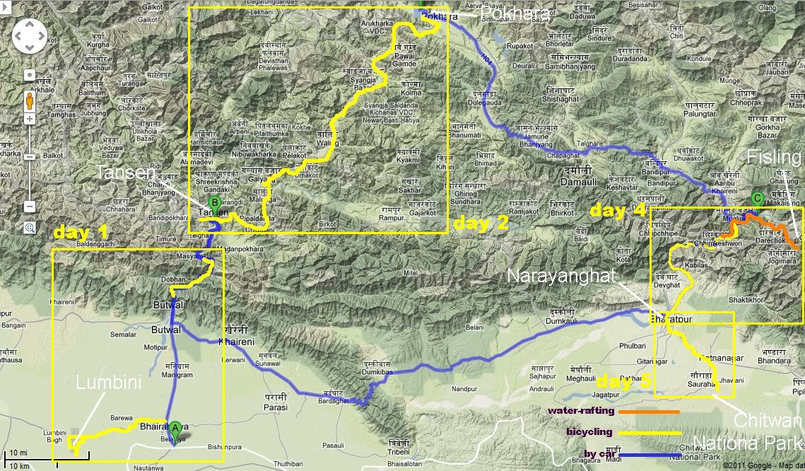
see
maps of nepal page for more maps.


* [ day 2: tansen-pokhara 120km]
* [ day 3: pokhara]
* [ day 4: fisling-rafting-nArAyanghAT]
* [ day 5: chitwan]
* [ day 3: pokhara]

[bumpy trails bicyclists homepage]     


amitabha mukerjee for the bumpy trail bicyclists. sep 2011.     feedback: mukerjee [at] gmail