| previous page: II | tour homepage | next page : IV |
day 4 - sarchu to brandy nala (jul 11)
by now we are accustomed to hitting the sack as soon as it gets dark and waking up real early. one reason you need to get up early in places like sarchu and pang is that you don't want too much "competition" when you go for the call of nature. bathroom facilities on this entire road are of course rather primitive. we slept above 4000m tonight. nobody is any the worse for it. as we get acclimatized, something in the brain tells the bone marrow to produce a lot more red cells - needed for transporting the rarefied oxygen. amazing why we have such a system in our genes, when for all i know all my ancestors may have lived in the plains of africa and eurasia... but then i have about 4000 generations of human ancestors, and if it's a dominant gene then all it would take is a single mountain experience somewhere... bio-philosophy aside, we need to fix a puncture on nandini's bike. we start off after a hearty egg breakfast...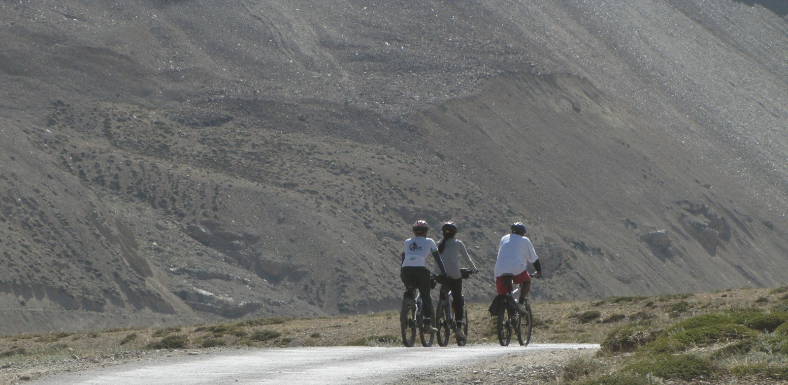
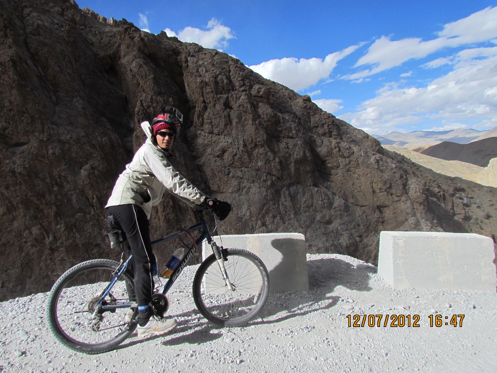
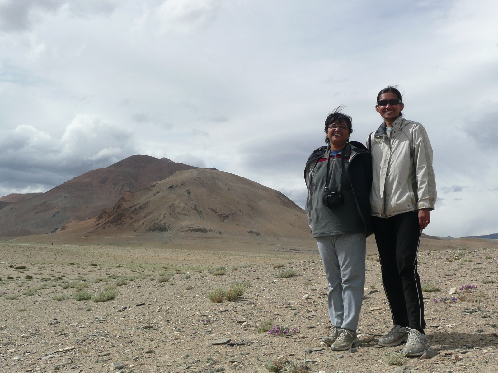
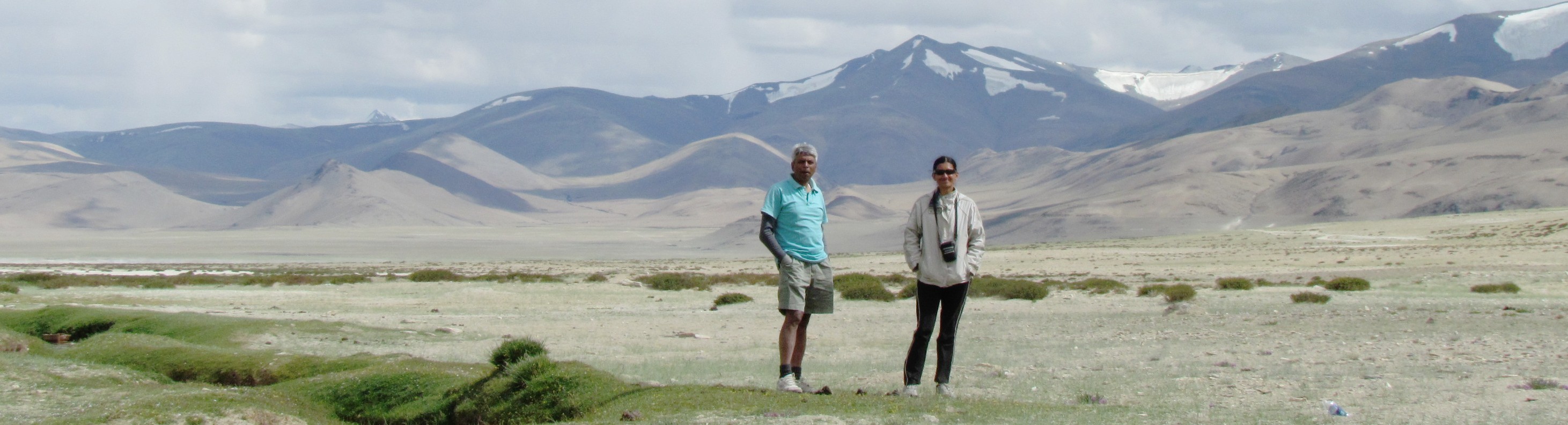
saumyen nandini amit - starting off from sarchu
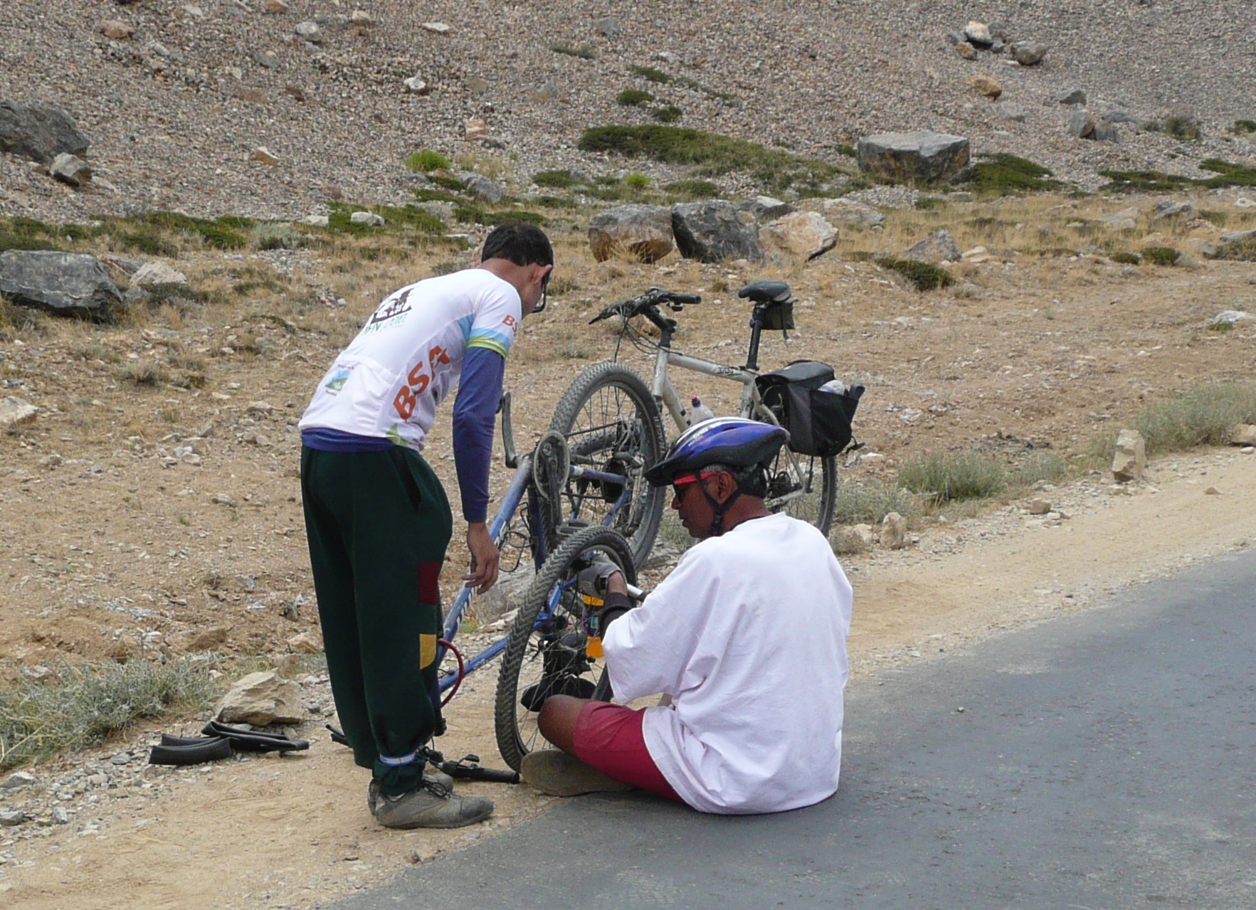
the schwinn fsport (ridden by nandini) had several puncture episodes. saumyen and amit, fixing it in the morning at sarchu. to cross an inlet, you often need to detour for a km or two. here's nandini at an inlet to the tsarap-chu.
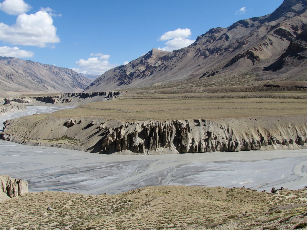
nandini amit saumyen. landscape near sarchu
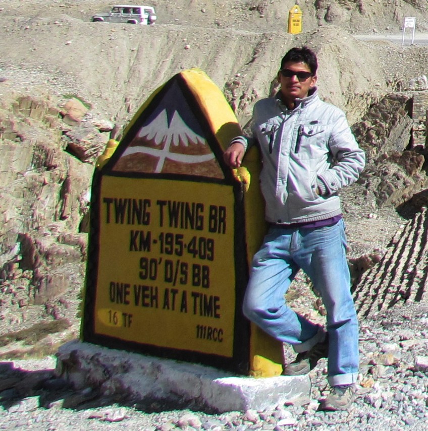
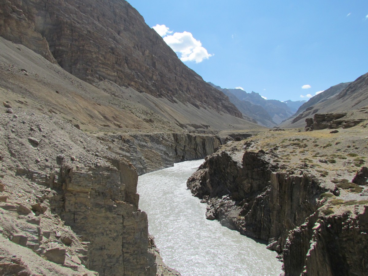
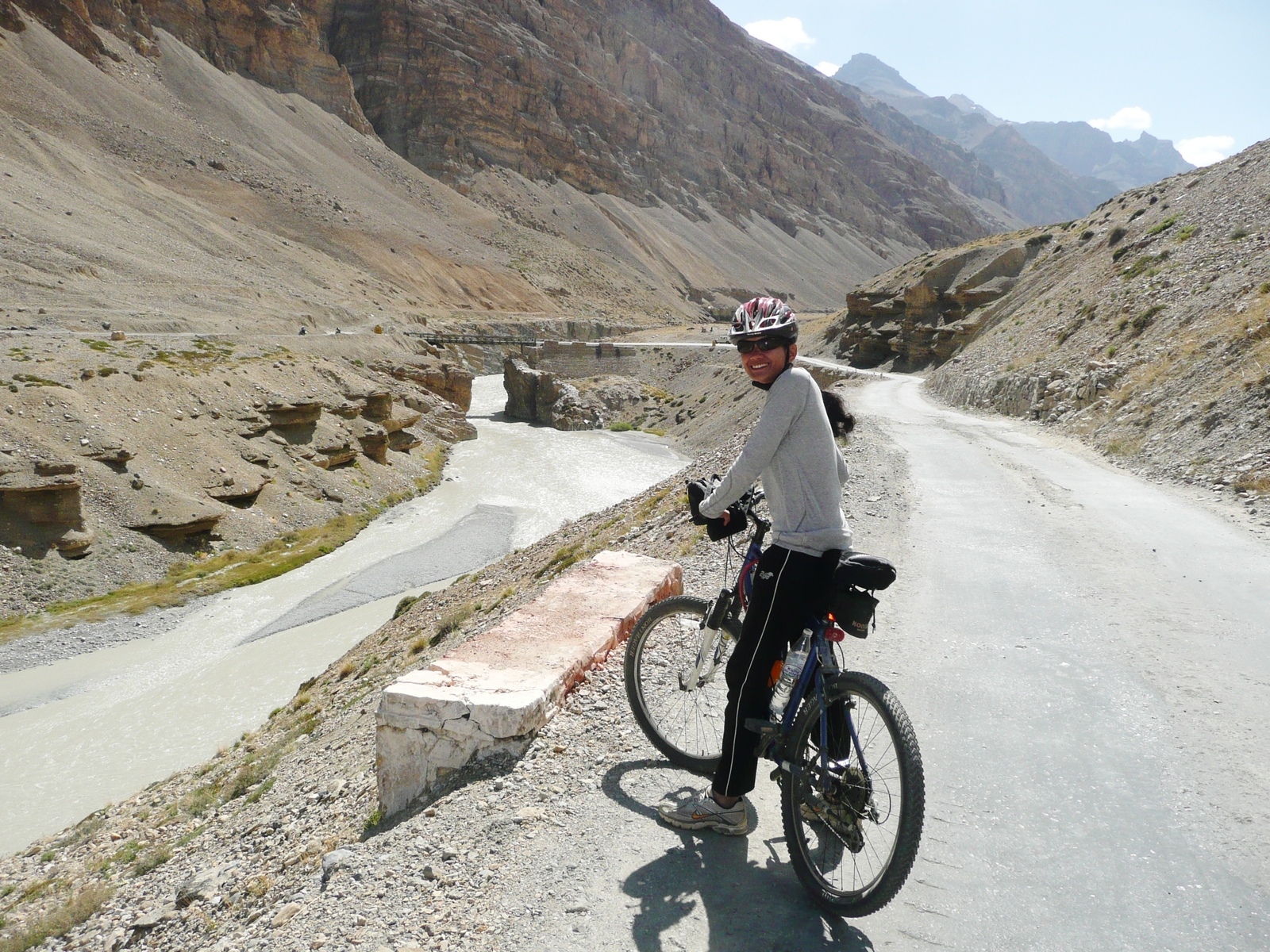
our driver bhimsen was helpful and full of good cheer - at "twing twing". tsarap chu river gorge
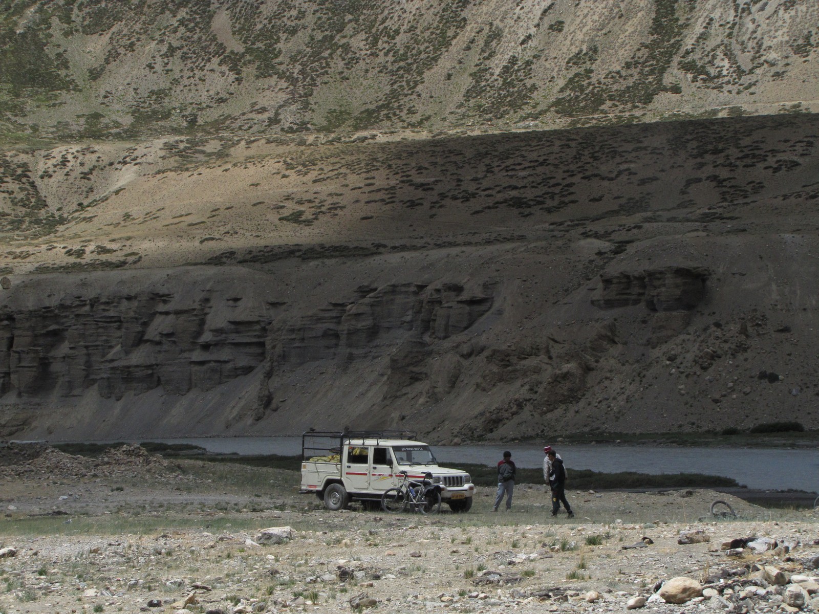
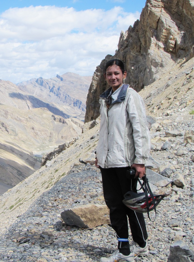
mohua nandini amit saumyen. saumyen nandini prospecting campsite brandy nala

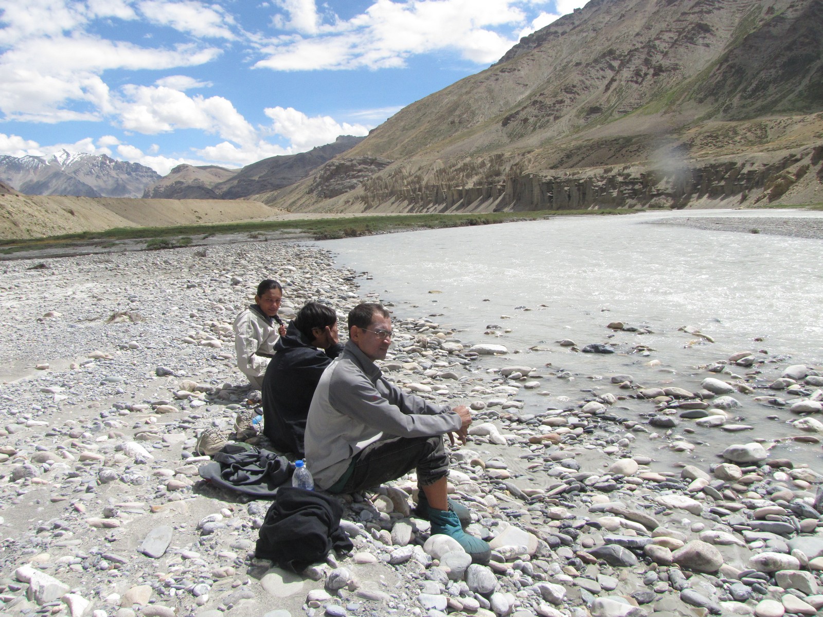
saumyen nandini. nandini mohua saumyen - tsarap-chu river
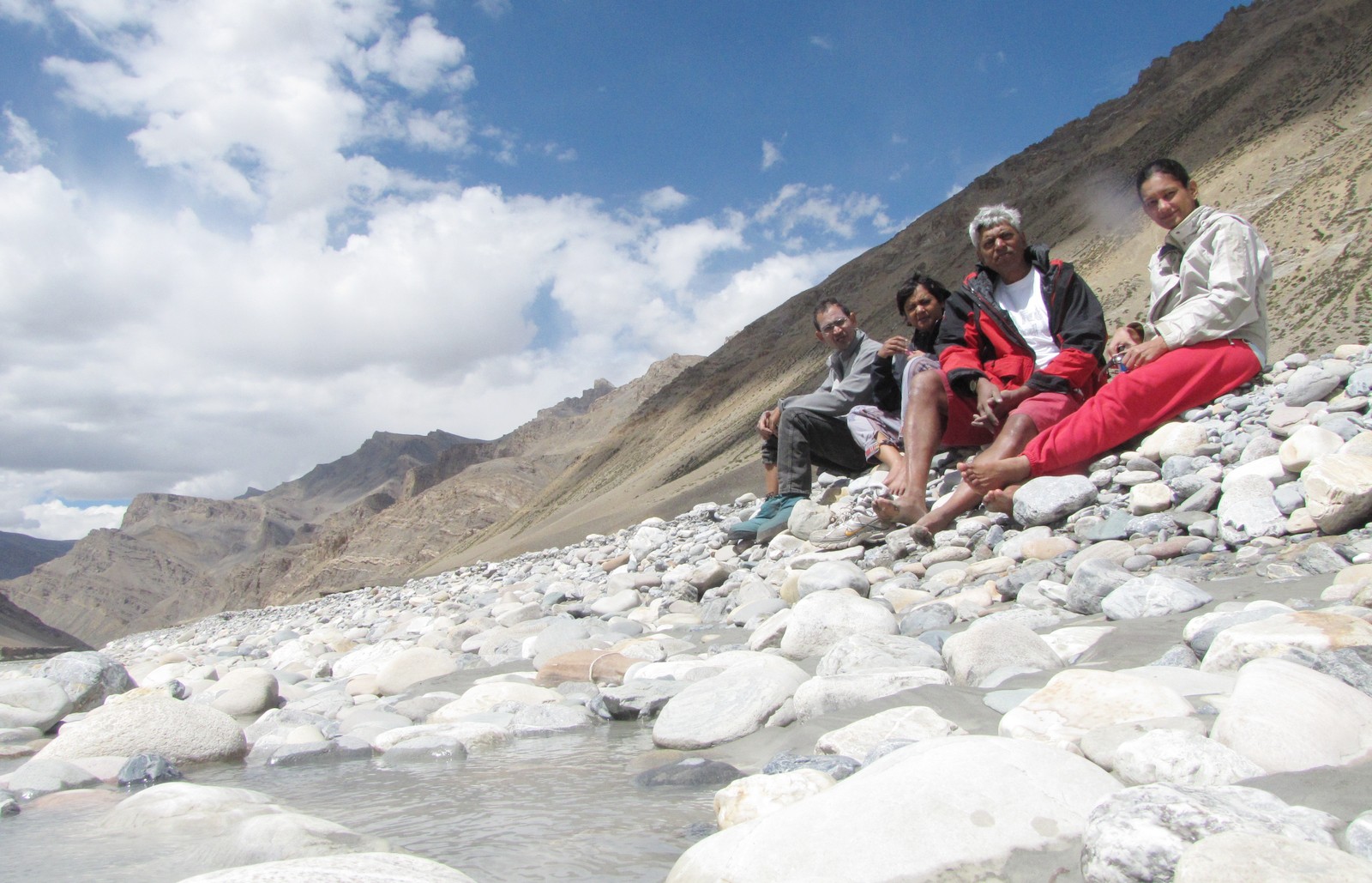
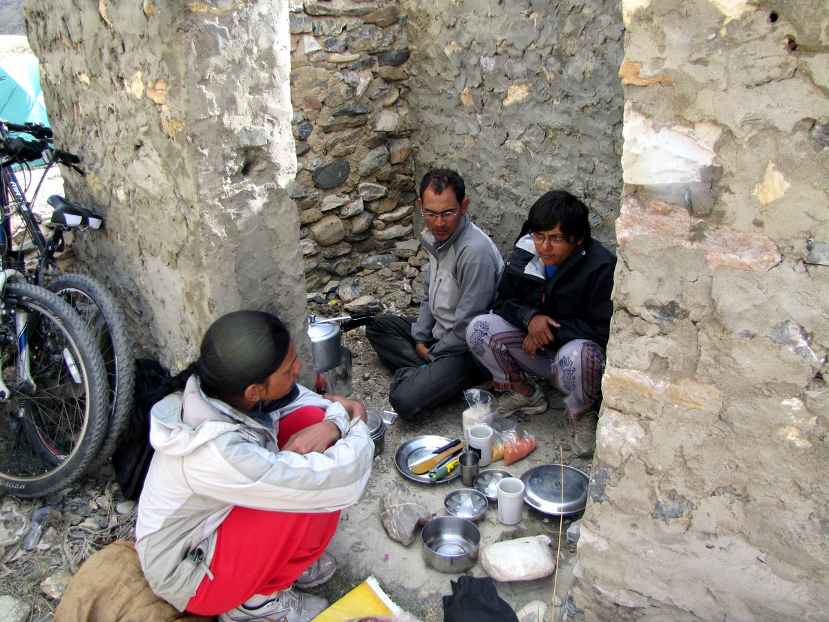
saumyen mohua amit nandini: river bank. cooking at brandy nala, 4250m. It took forever for the whistle to blow on our pressure cooker of khichri.
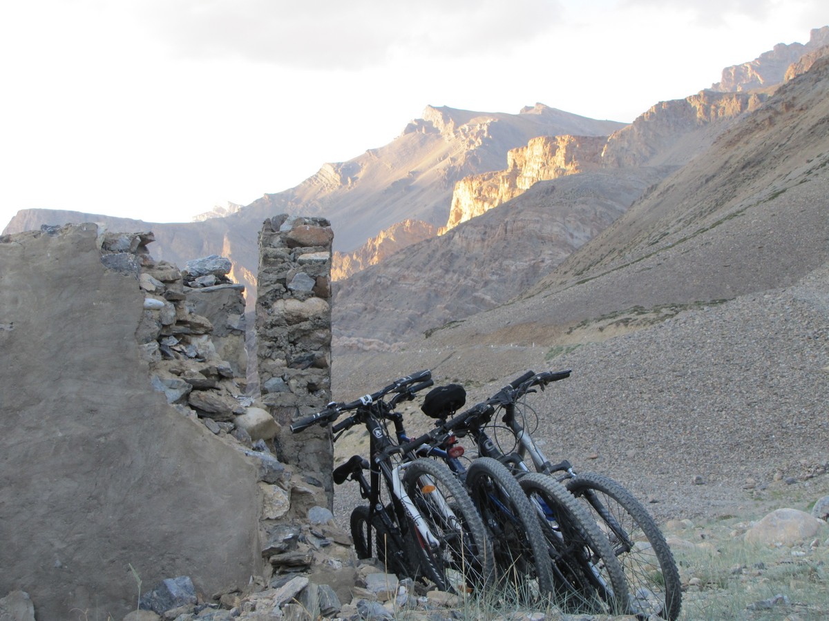
brandy nala landscape with bicycles
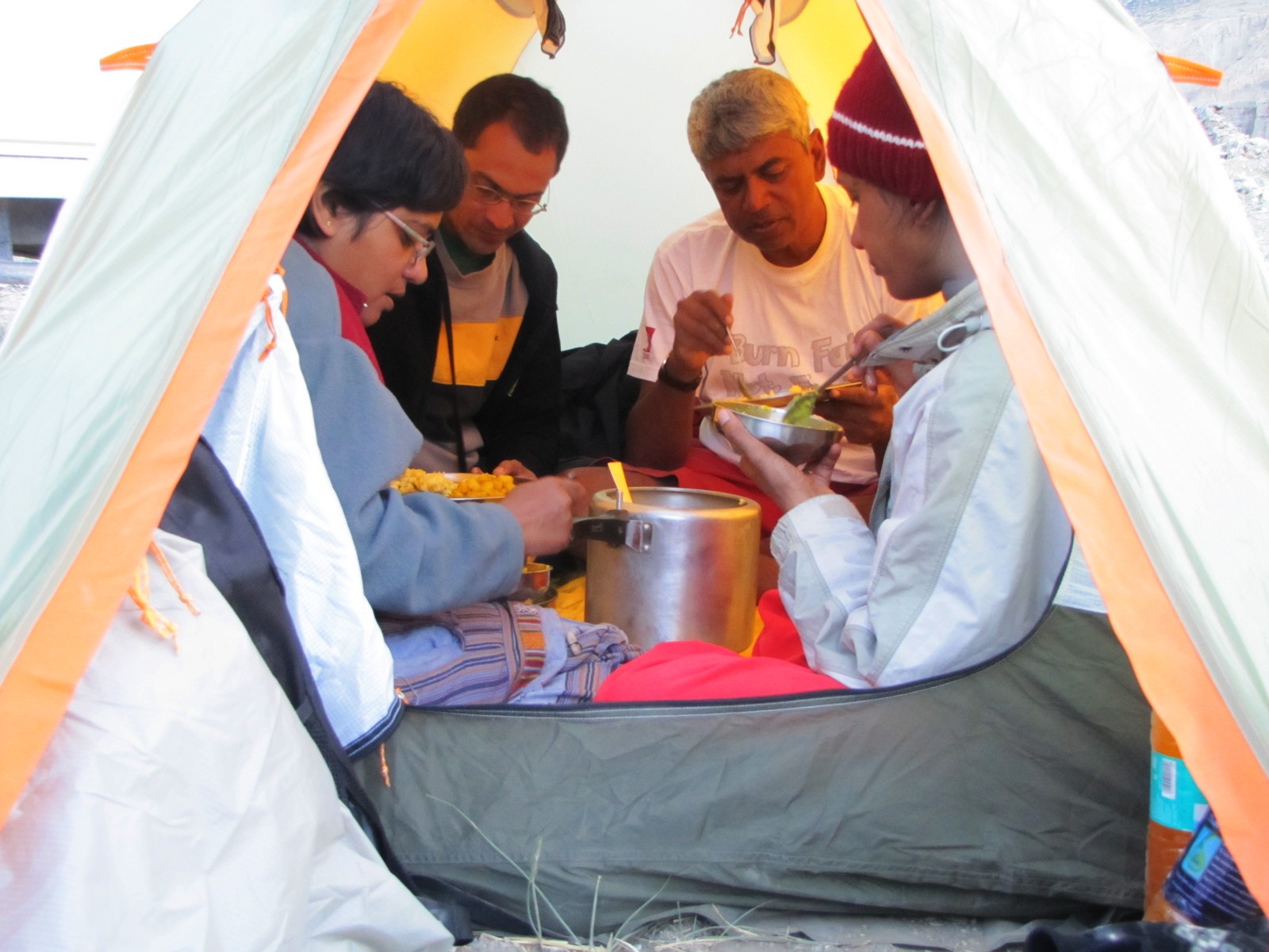
a well deserved dinner inside the tent. tomorrow morning, we'll be starting with the gata loops climb!
Fact Sheet: Sarchu to brandy nala
	27km Brandy Nalah.  foot of gata loops.

	Lodgings:  Need to carry tent.				[+27k 256k]

	Food:  In the car, we were carrying a pressure cooker, potatoes,
		rice, dAl, etc. for a nice khichuri meal.

	[Those travelling light need to do the whole stretch, climbing the
	two big passes of Nakeela and Lachulung La, directly from Sarchu -
	total of 90k.  The Spanish couple we met were carrying tents, though
	what they did for food we don't know. ]
day 4 - brandy nala to pang [nakeela, lachulungla 5070m) (jul 12)
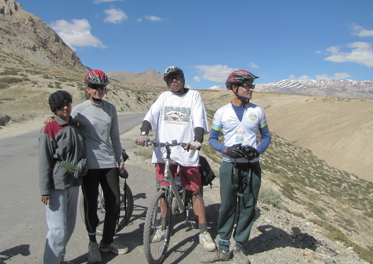
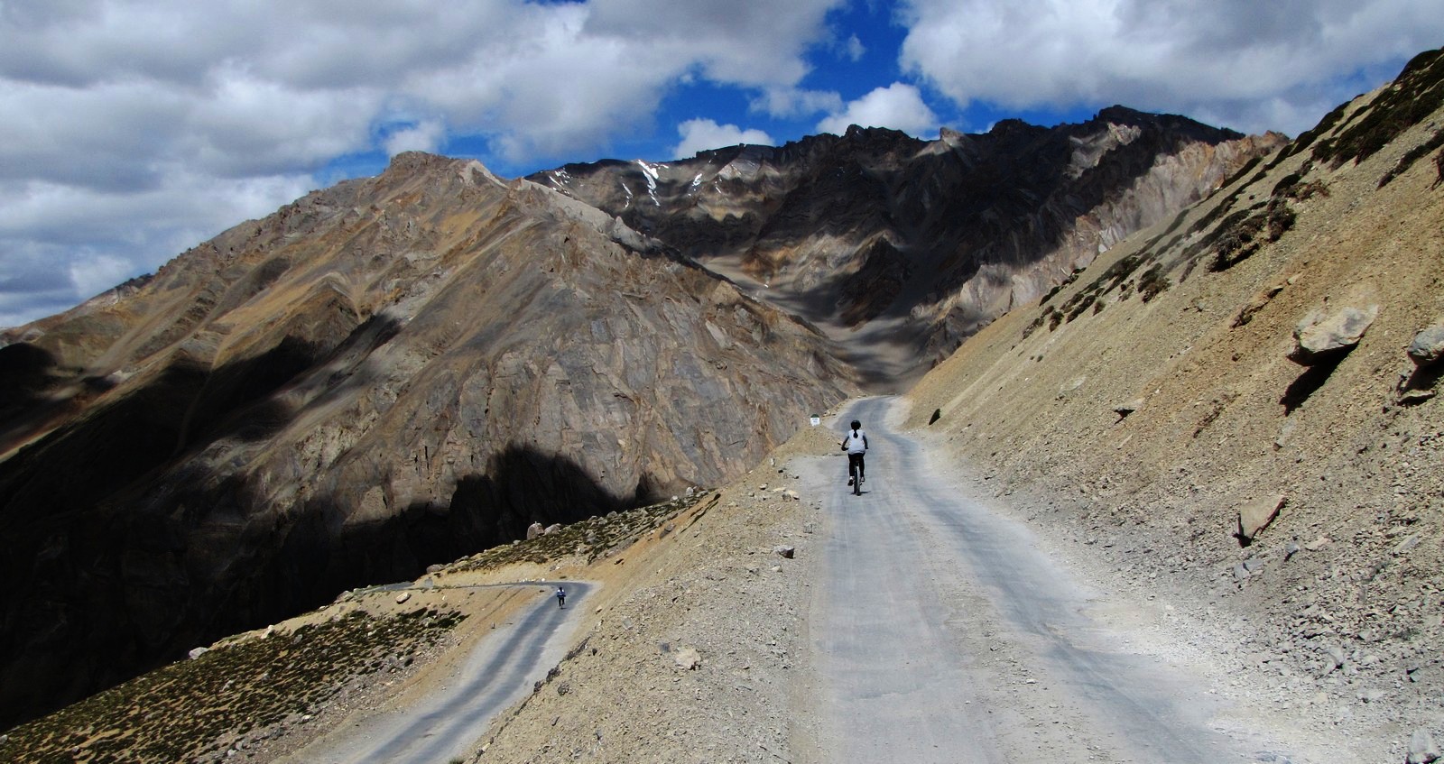
Despite their fearsome reputation, the gata loops - climbing about 440m in 9km - is actually not that serious a challenge. but all those switchbacks - 21 of them - do leave an impression on the mind. at the top, you leave the tsarap chu which you have been following for two days, and head up to some serious 5000m passes. mohua isn't feeling upto it today, most of the day she is in the car. even saumyen has had a toothache since yesterday, and is worried it may be an infection. but he is riding fine. .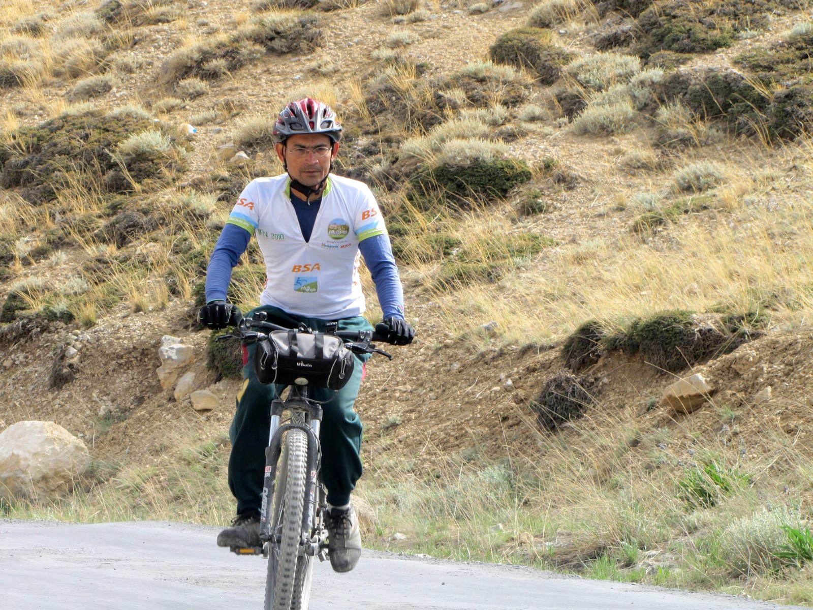
saumyen starting the gata loops climb. nandini ekla chalo re g
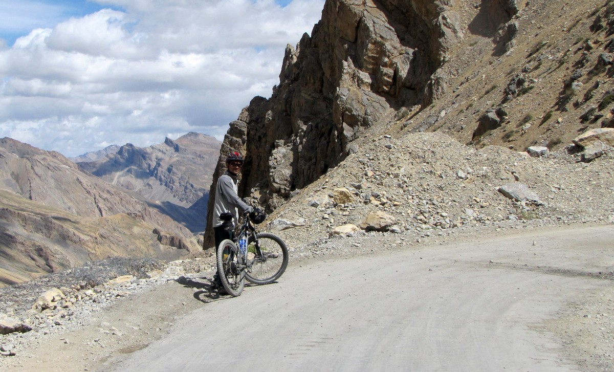
nandini. saumyen at a bend in the road
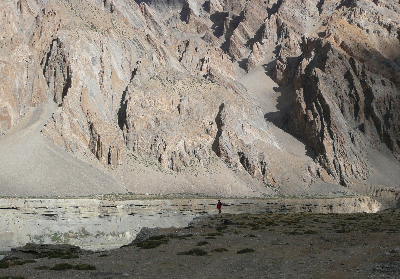
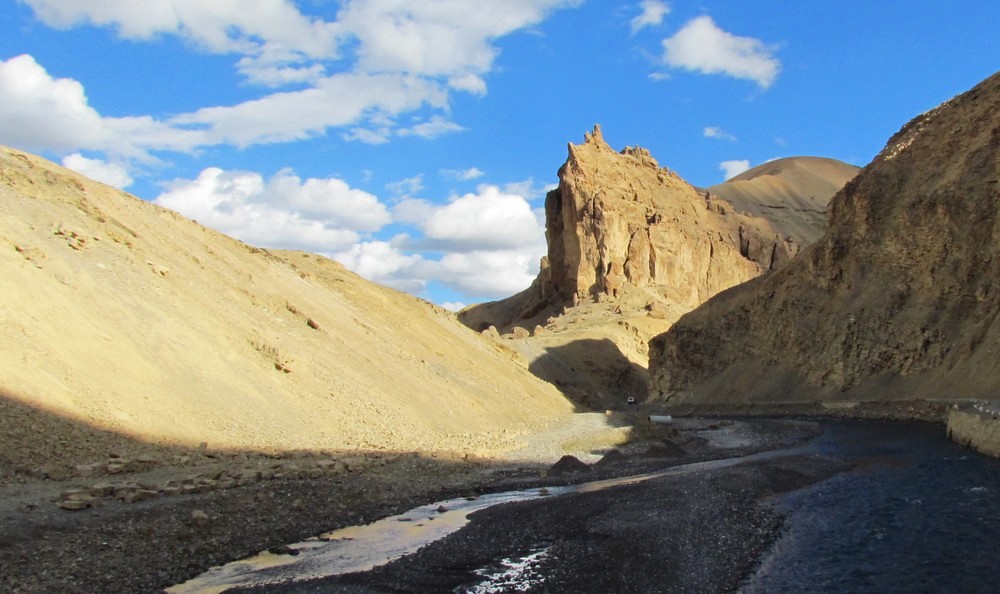
at one with nature - at the edge of the tsarap-chu gorge... (see this point on the map: lat-long: 32.943573,77.603146)
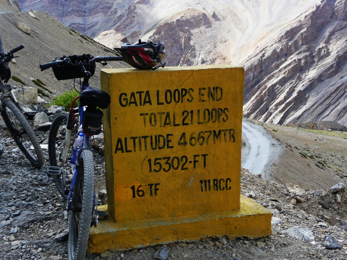
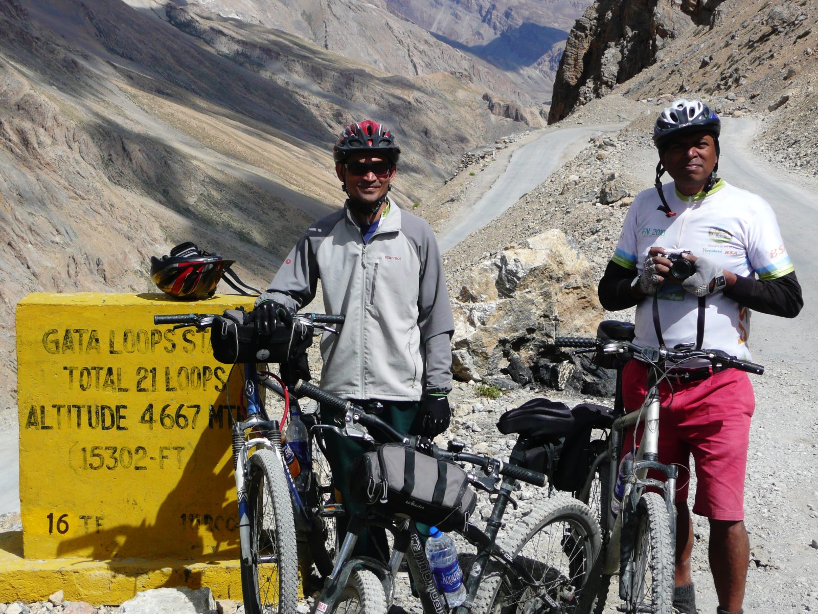
gata loops end. amit saumyen: top of gata
nandini saumyen am: lachulung la 5070m.
... all experience is an arch wherethro' / gleams that untravell'd world. nandini
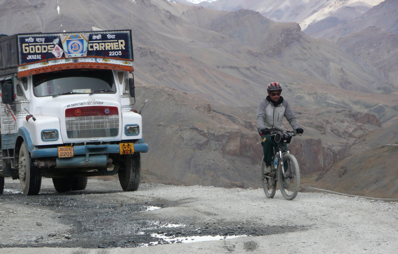
saumyen: tata truck. nandini saumyen
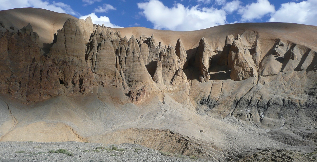
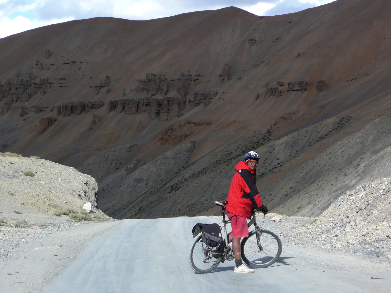
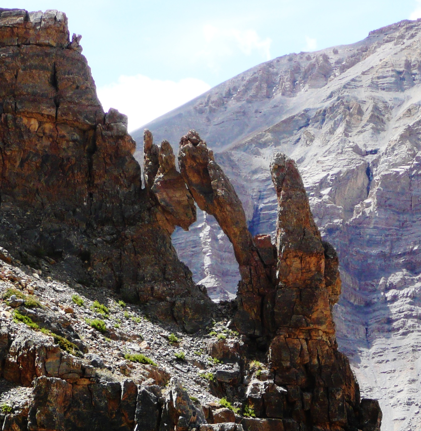
mud towers gorge. amit
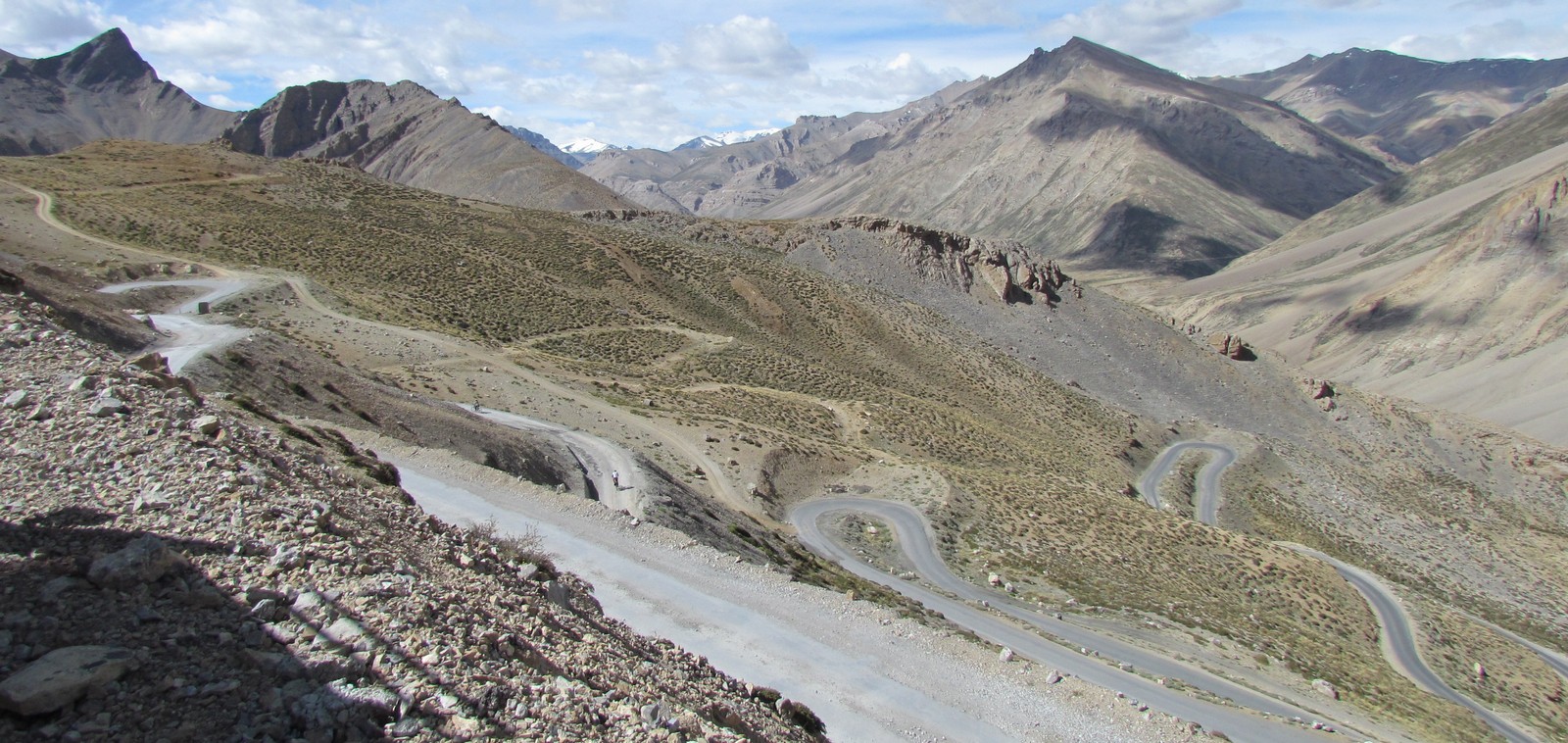
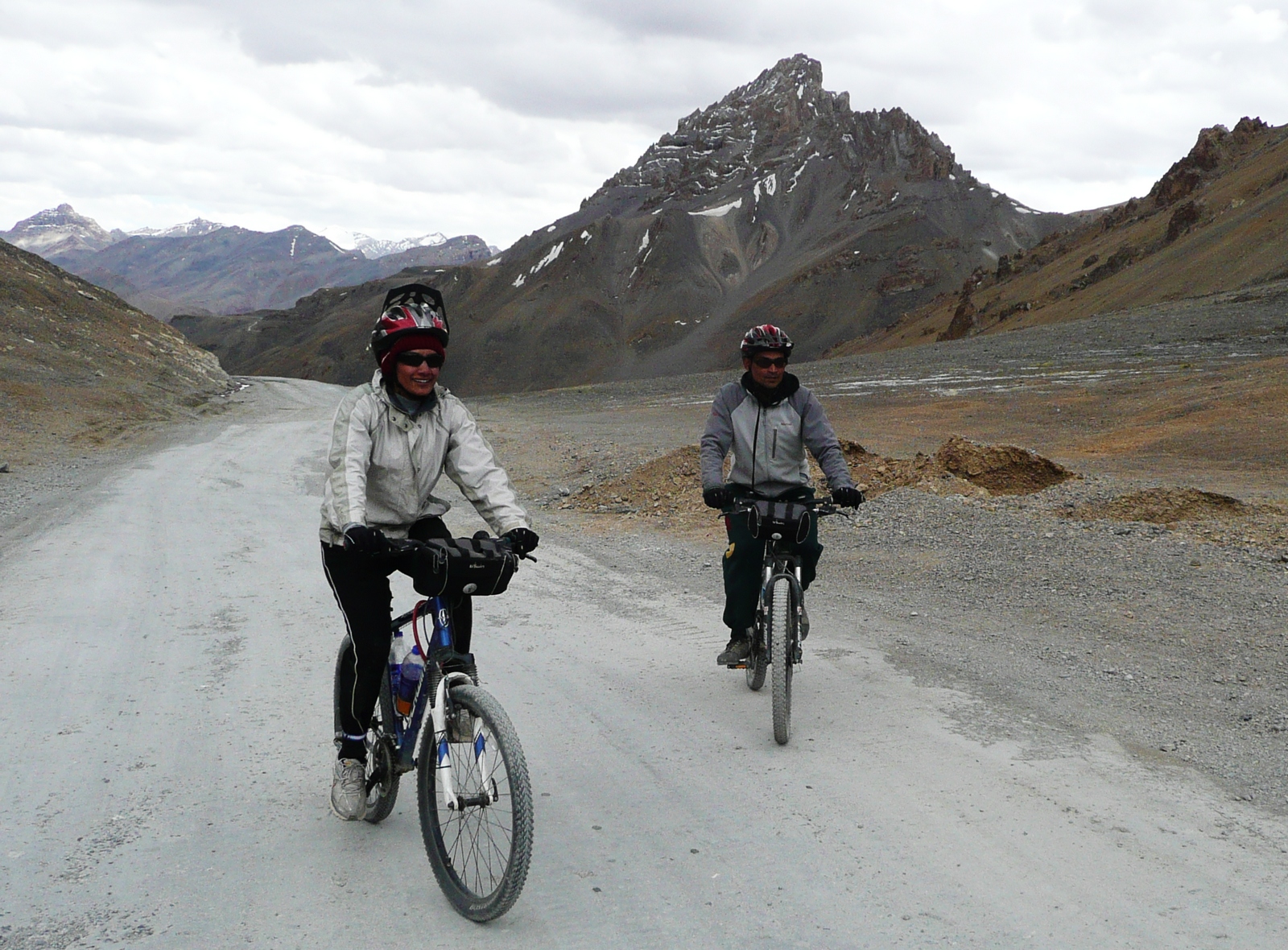
nandini saumyen: gata loops landscape
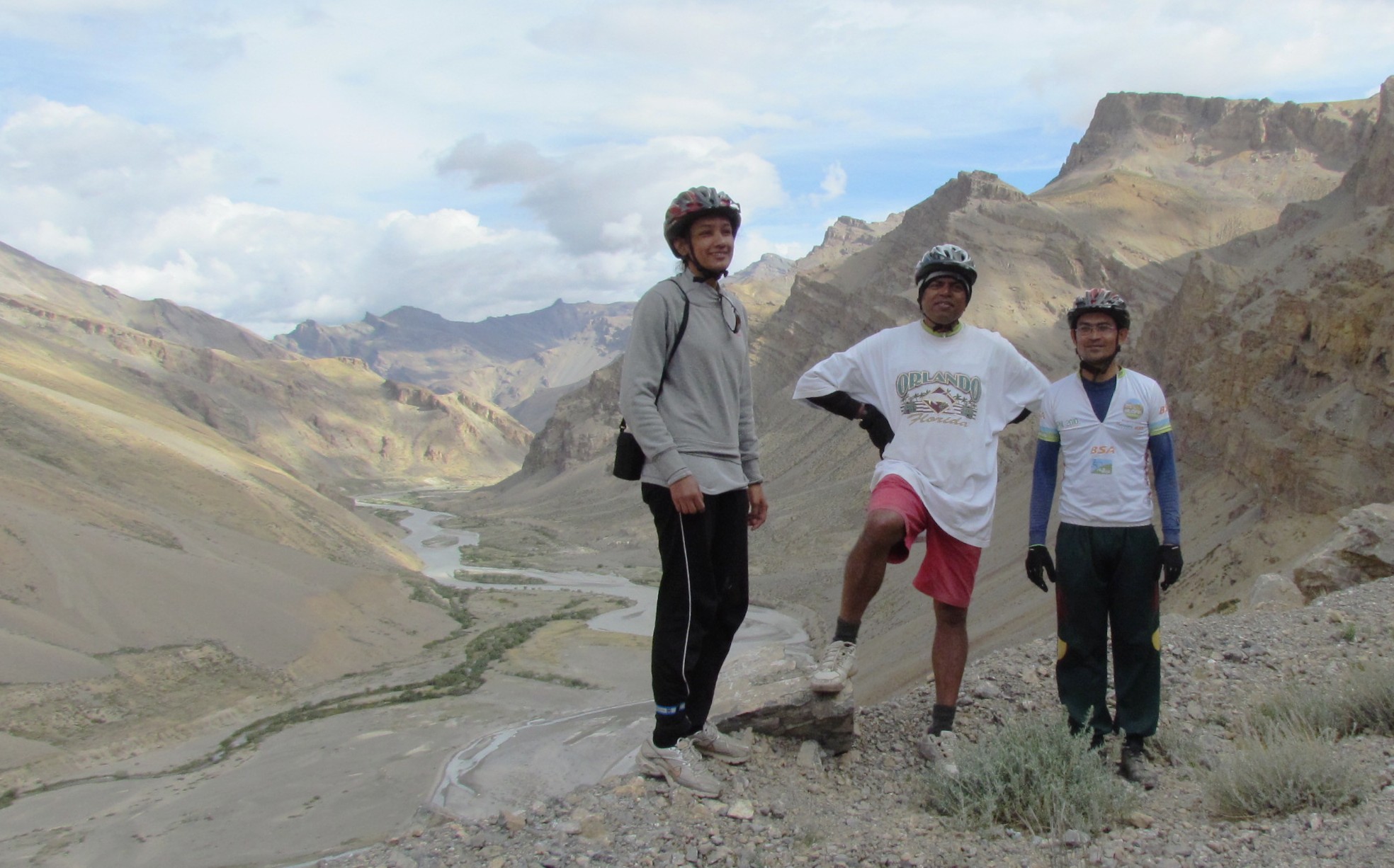
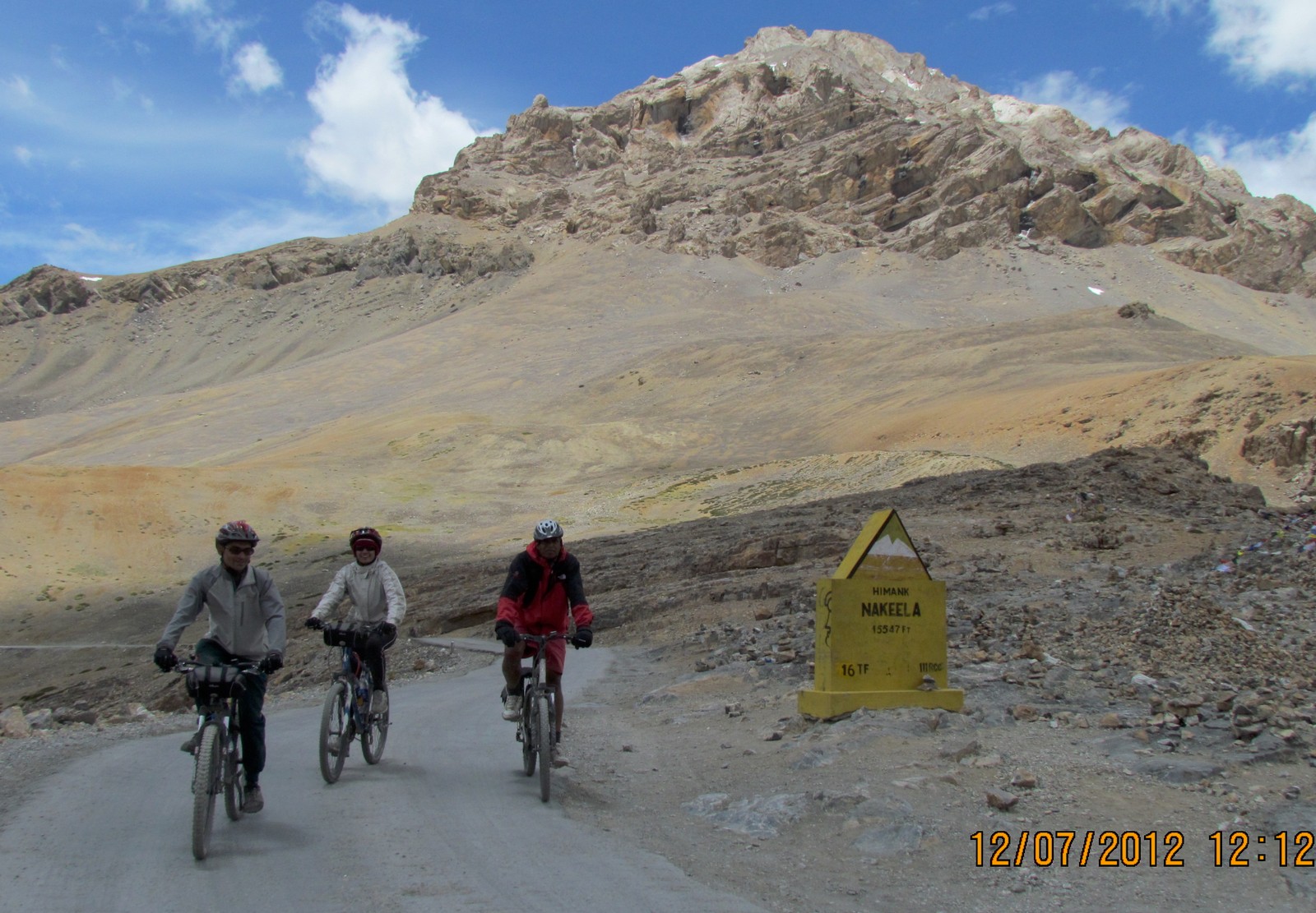
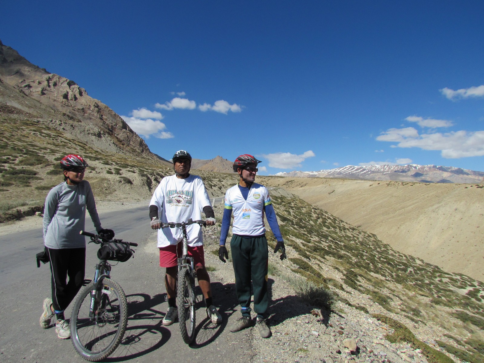
posing in front of the tsarap chu valley. saumyen, nandini and amit reaching nakeela, 4937m: 12noon
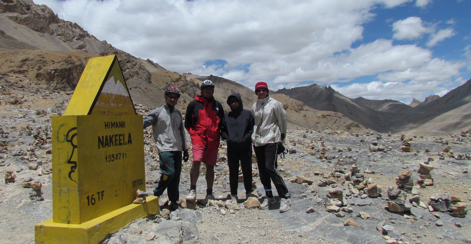
group photo at nakeela. saumyen amit mohua nandini
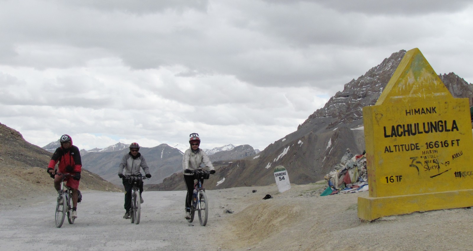
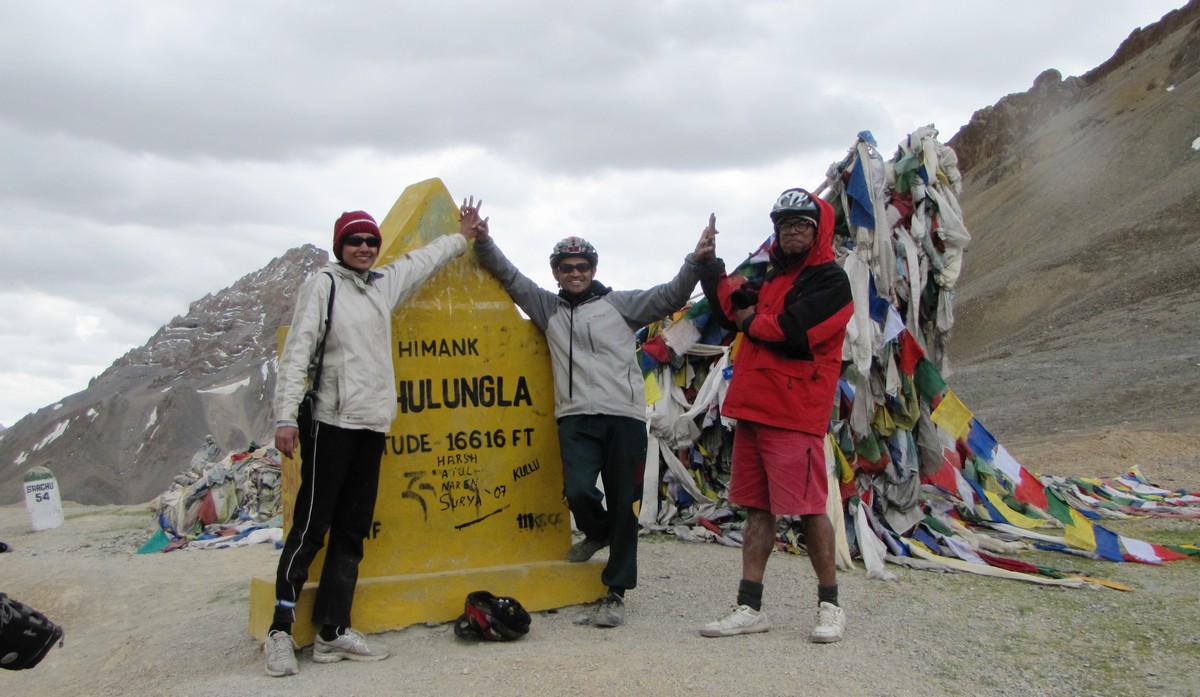
amit saumyen nandini: triumphantly crossing lachulungla, 5077m
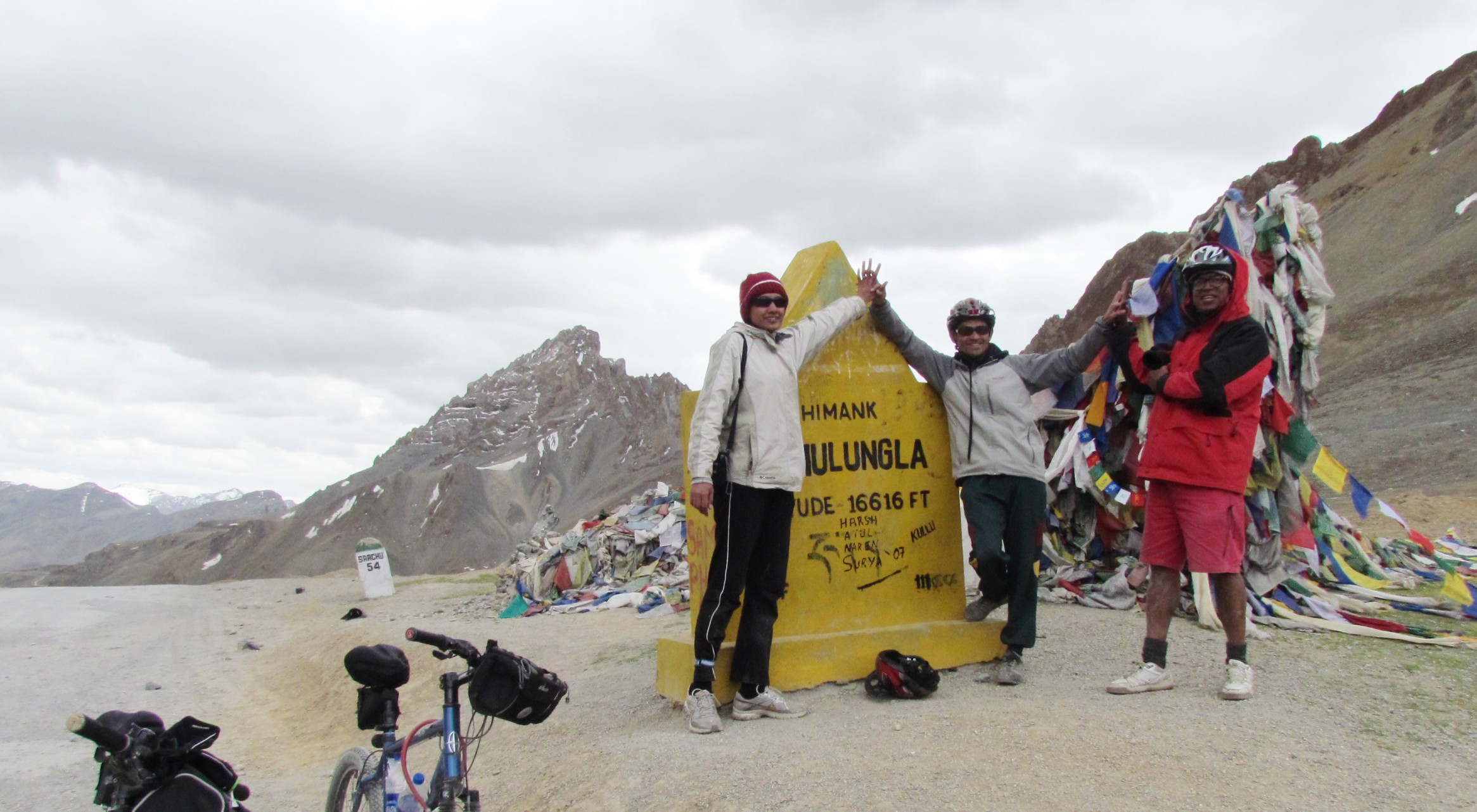
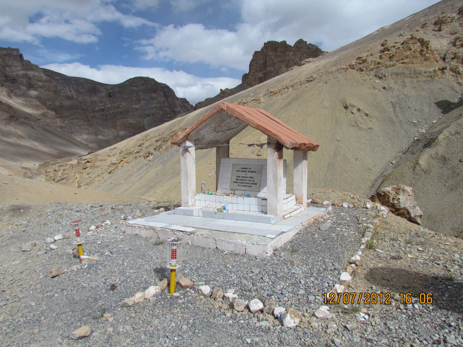
amit saumyen nandini: high five at lachulungla. in a reminder to how much work it takes to keep this road serviceable, we crossed a memorial to capt. somesh srivastava, who had died here, along with his driver, while preparing the road for summer traffic.
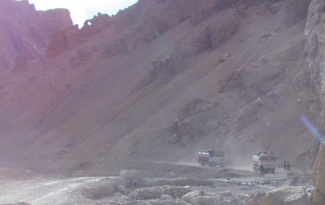
nandini saumyen amit truck traffic
nandini in dashing pose
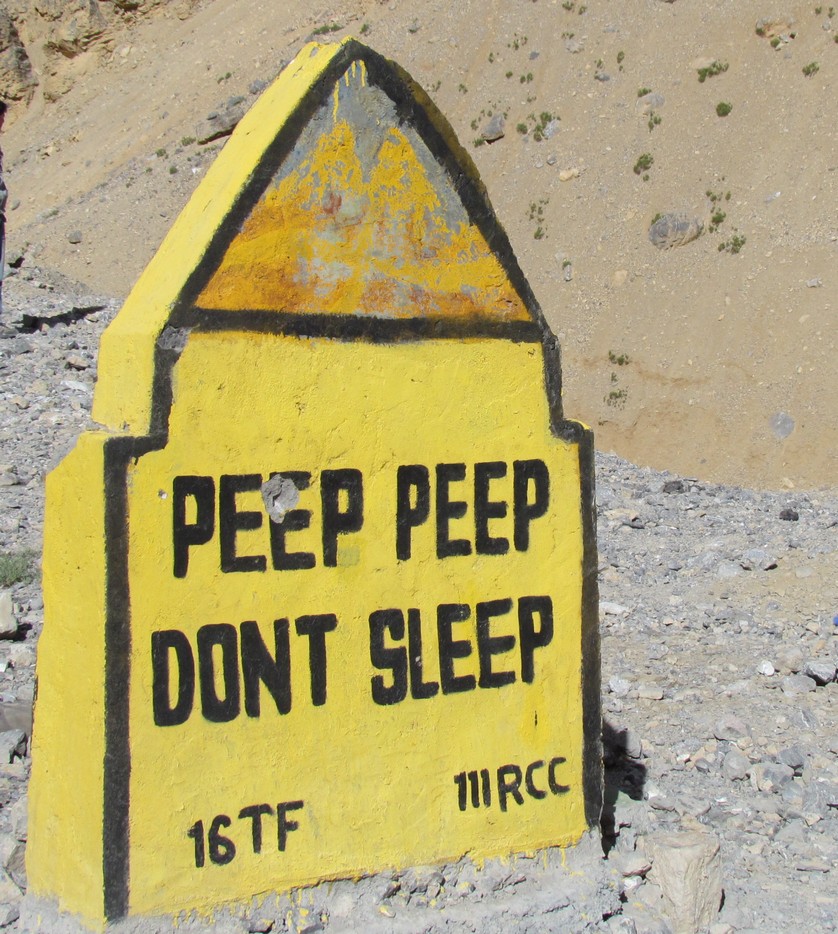
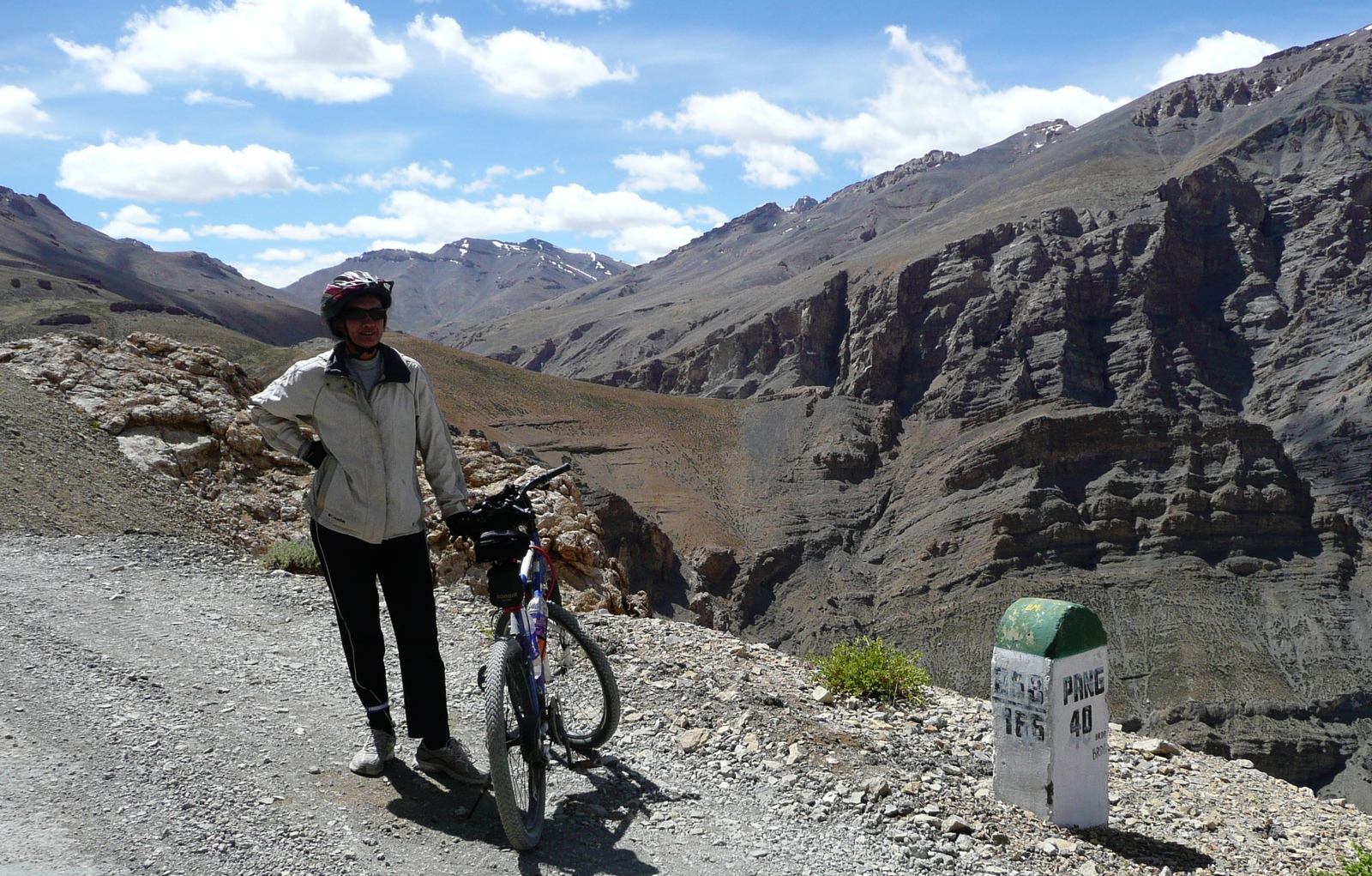
the BRO tries its hand and holding the drivers attention: "peep peep dont sleep". some beautiful landscapes as we approach pang.
FactSheet: Brandy nala to Pang
JUL 11:  Brandy Nalah (4222 m) to Pang (4522 m) Total 52.5km
	        CROSS Nakeela La (4937 m) and Lachulung La (5077 m).
   *** Dates after JUL 11 may be +1 if extra day taken at Sarchu
		[nonstop climb 800m over 20km; all above 4000m ***no water]

	0km Gata loops -  start 21 zigzags 4222 to 4627m
	9km top of gata loops [carry water]
		[nonstop climb 800m over 20km]
	19.5km Nakee la 4937m  [?gmaps: 4739m]
		[a small downhill (130m 4km) now]
	24km Whisky nala [Biskynala]  4802 m
	     [another climb starts 275m in 8km]
	32km Lachulung La (5077m) [gmaps: 5065m]
	53km Pang  4550m  stay at Parachute tent		  		[+53k 309k]
		Pang is a military camp town - a large army truck stop

Note: there is no phone or mobile connection from well before patseo, for
pretty much the whole route.   if you are nice, the army people can sometimes
hook you up over their BSNL wide area network.   but even this is not there
after Patseo itself.  At pang you may get a phone connection.  Even power,
for recharging camera batteries etc, is problematic.
day 5-6 - pang to tsokar; tsokar to leh (by car, jul 13-14)
saumyen's fever is no better and we decide to pack the cycles and go on the truck. it was a good decision actually, since after climbing up from pang we reach the morey plains (also spelt "morei", "more"). after some time, the tarmac-ed road finishes and we find that we will have to go some 20 km on what is essentially a high-altitude desert. there are trucks stranded here and there, with their wheels unable to find traction to proceed. there is a large group of workers who are working on a new tarmac highway. meanwhile, bhimsen manages to find a path for our two-wheel truck. we ask people for directions to tso-kar, a high altitude lake, which was part of the sea millions of years ago, and still has large fields of salt along its bank. though it is fed by freshwater streams, its water remains saline, though less so than tso-pangong. we reach tso-kar where we find a luxury tent resort. yes, they have space, we are fortunate. saumyen lies down to take rest. in the large dining tent, they serve us a gourmet lunch - pasta with garlic-sauteed vegetables. M N and I go for a long walk. Nandini has some close encounters with the elegant tibetan wild ass or kyang. the bathrooms are also tents, but they have commodes. we are still at 4500m. saumyen is on crocin, but his fever keeps coming back. he is worried about getting altitude sickness. another well-equipped group arrives (a group of U. Pennsylvania students), and yes, they do have oxygen and if it's an emergency they could possibly help us.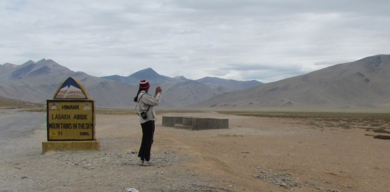
on the morey plains. this is one of the better patches of road. exploring tso-kar: mohua nandini
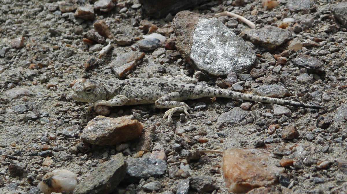
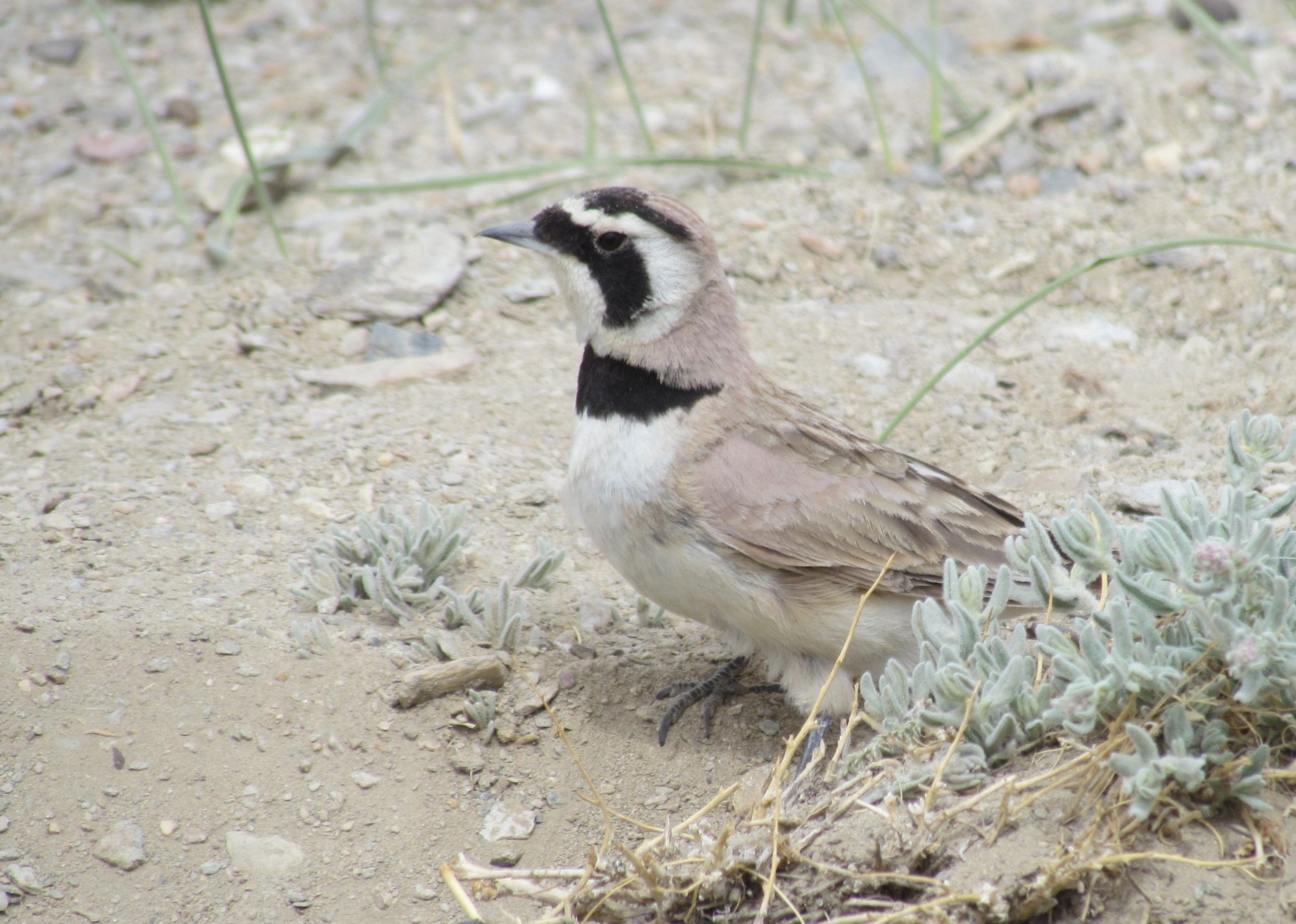
beautifully camouflaged lizard sunniing himself at tsokar. bird at tso-kar.
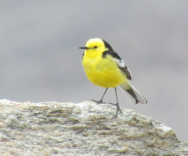
this yellow lady rose up from a bush when we walked too close. well hidden in the bush was a nest with a clutch of four small brown eggs.
the tso-kar plains : amit and nandini
kyang: tibetan wild ass
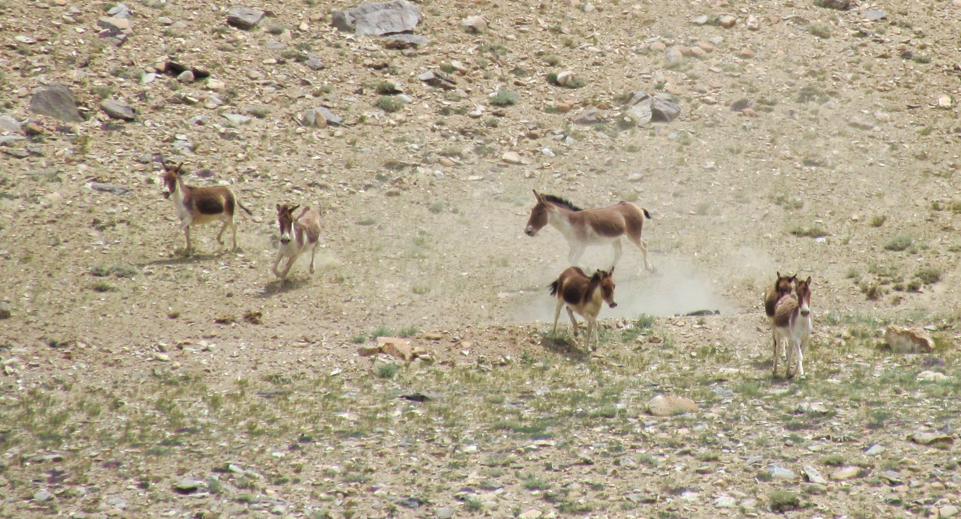
our first sighting of a small herd of kyang runniing gracefully on a hillside.
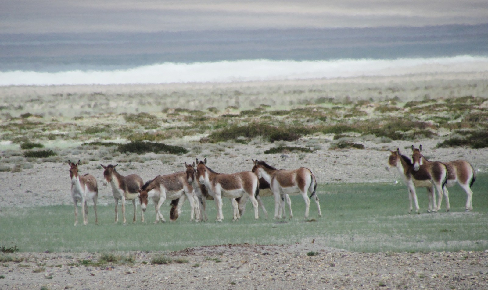
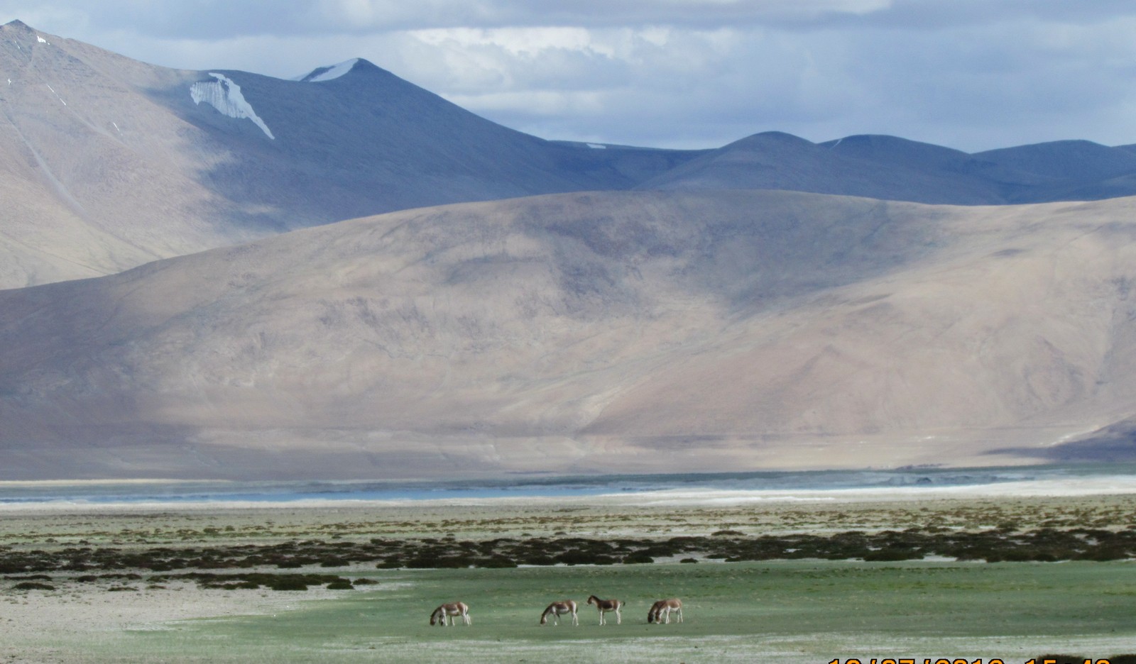
later, we saw another herd at a grassy spot near the lake
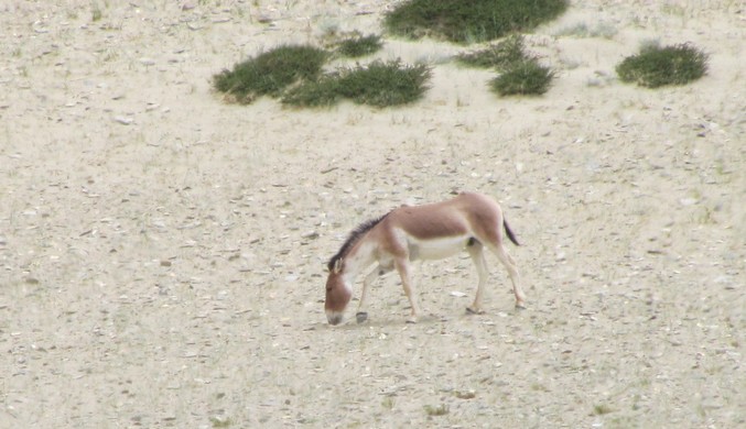
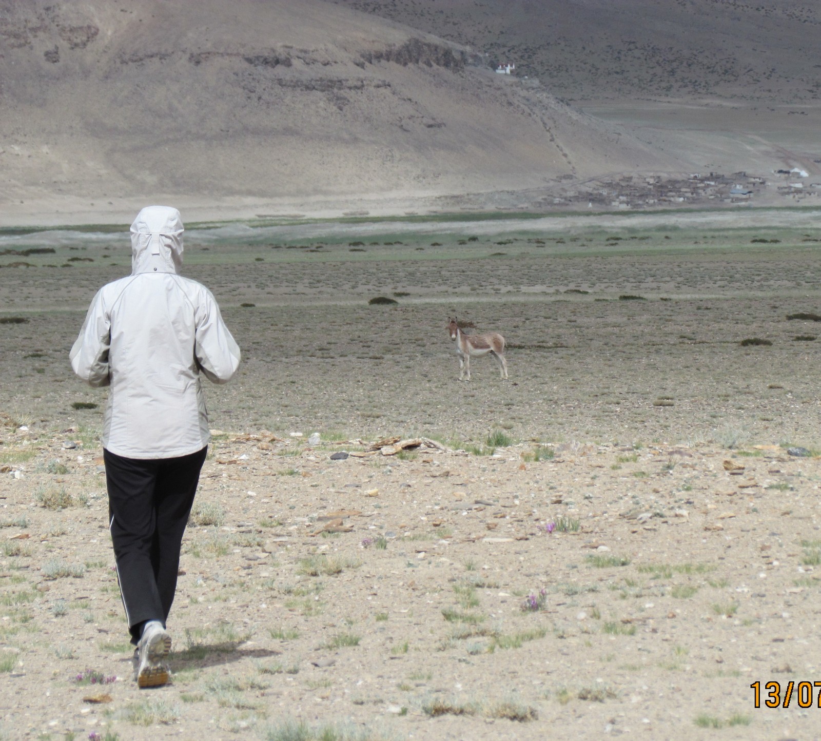
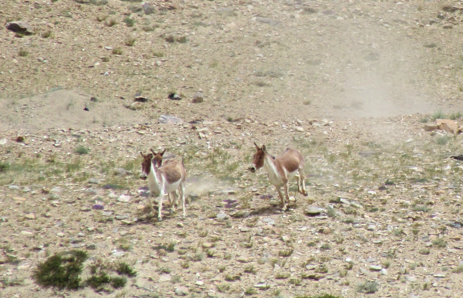
we also saw a solitary individual - probably a non-dominant male - from fairly close by. nandini tried walking towards it, hoping to pet him. of course he ran away. and in any event, kyangs are impossible to tame, and have a ferocious rear-leg kick.
himalayan pika (or tibetan pika)
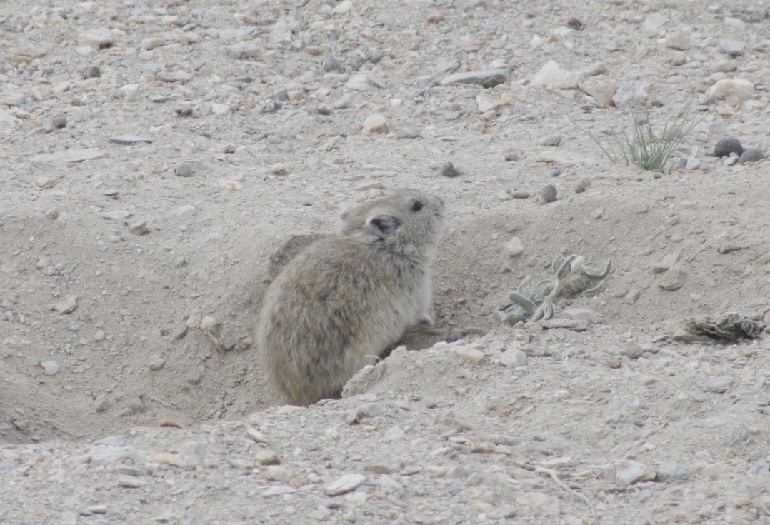
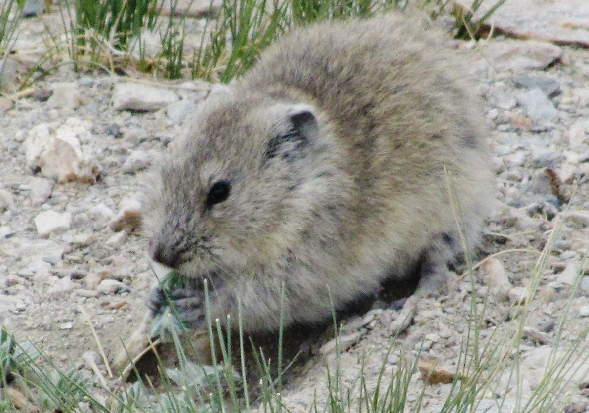
himalayan pika at tsokar. holding something with its front paws.
Factsheet: Pang to Tsokar
JUL 12:  Pang (4522 m) to Tso Kar (4515 m) Total : 47k

	0km  cross army camp, short climb through 5 switchbacks
	7.8km Morei Plains  4700m  heading N
	        	[steep hills to right (W) climbing to 5350m ridge]
	        	[marmots, pika, herds of tibetan wild ass (kyang)]
	33km - may be able to see Tso Kar lake - 2km to E below a ridge]
	40km Tso Kar Turn Off
	 	["jeep track" - LS; but "new road" (41km) may be ready]
		Pongunagu village [area in Rupshu wildlife sanctuary]
			[endangered back-neck crane]
	47k Tso Kar camp beside a stream  [lake alt. 4515m]			[+47k 356k]

  	   	Nearly flat, an easy 3 hour ride.  Relax the PM by Tso Kar in the tents.
		   	Chang-Pa nomad settlement at Thukje 4424m 10km to E
			deserted in summer - herding goats w Pashm --> pashmina]
Factsheet: Tsokar to Leh
Though we made this part of the trip by car, here are the facts for those planning to do this route later.JUL 13: Tso Kar (4522 m) to Lato (4021 m) Total 73 Km Cross TagLang La (5300 m) 7km Tso Kar-Highway Junction 16km end of plain valley -road starts rising steadily continuous climb, no major switchbacks 27km Debring 34km Taglang la 5300m abt same as Khardung La Khardung La is signposted 5602m, but more accurate GPS has 5359m, while Taglangla may be 5360m road circumnavigates small hill to the right 5450m 42km-57km - six long switchbacks climbing down over 15km from 5150m to 4500m to Gya river Rumtse village - parachute tents, maggi 69km Gya village 73km Lato - 4021m Home Stay or Tent [rs50 camping charge] [+73k 429k] Continuous climb (800m / 27km) from Highway Jn to Taglang La continuous descent to Lato. If we reach Lato at reasonable time, we can continue to Upshi (another 23 Km downhill). THE MAIN CLIMBS ARE OVER now... JUL 14: Lato (4021 m) to Leh (3563 m). Total 72 Km. Miru 3712m - gorge with scenic geological formation 22km Indus river, road turns left (N), 1km to Upshi 23km Upshi cross Indus at Mahe bridge; follow river upstream 33km Karu - road to Hemis monastery across bridge- famous 11th c. monastery - 7km detour 300m climb 45km prominent Stakna gompa on hill across - 2km detour stak-na = tiger's nose = shape of hill [drugpa sect; 16th c.] 54km Thikse 3243m - huge 12story monastery on hill by the highway [gelugpa sect; 15th c.] 65km Choglamsar [3230m] [climb 300m] 72km Leh [3560m] [can go via main bazar to outlying Changspa area] Milarepa (expensive hotel) - ~ rs 1k - some rooms w views of stok kangri [+72k 501k] Khardung la: 40km - abt 7 hours - 5 going, 2 back* page I: day 0-1: [manali-leh trip homepage]
* page II: day 2-3: [keylong-patseo-sarchu]
* page IV: day 7-9: [leh, pangong lake, masked dance, zanskar]
html index automatically created on Sun Jul 29 IST 2012. Last update: 2014 Jun